


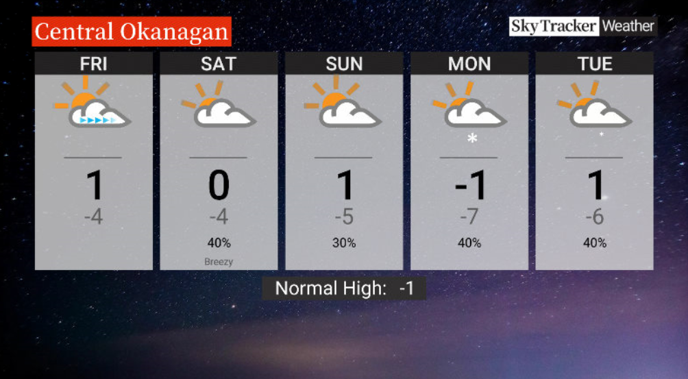
After a period of cloudier skies, sunshine finally returned to the valley bottom on Thursday with temperatures climbing back up above 0 C.

The mix of sun and cloud will also continue into the end of the week with the mercury making its way just above the freezing mark later in the day after starting out around -4 C.
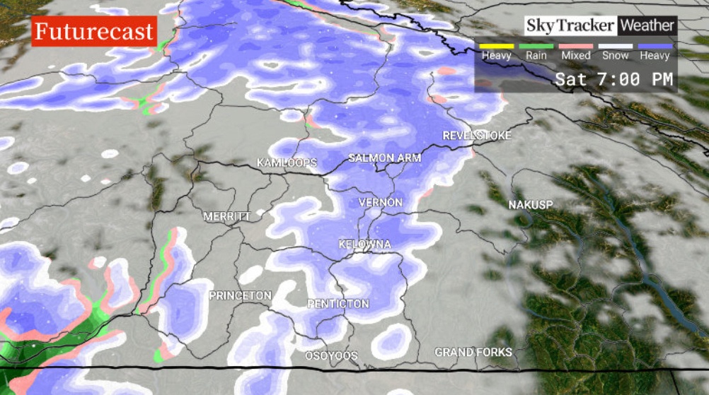
The risk of flurries returns on Saturday as a disturbance passes through and skies clear out to finish the weekend on Sunday.

Get daily National news
Daytime highs over the weekend will stay just above the freezing mark with morning lows in mid-minus single digits.
The work week ahead will see cooler air with afternoon temperatures struggling to get above zero and overnight lows well below freezing.
- A ferocious Hurricane Simon nears Mexico with 155 mph winds and flooding fears
- Simon strengthens into a Category 4 hurricane as it approaches Mexico’s coast
- Isaias weakens but flash flooding threat persist as hundred of thousands grapple with power outages
- Support pours in for tortoise ahead of surgery


For weather on the go download the Global News SkyTracker Weather App for iPhone, iPad or Android.


Comments
Want to discuss? Please read our Commenting Policy first.