
A smoky skies bulletin has been issued for the South Okanagan.

The Keremeos Creek wildfire, located near Apex Mountain Resort, has quickly mushroomed in size, growing to 150 hectares on Saturday, up from 100 on Friday when it was discovered.
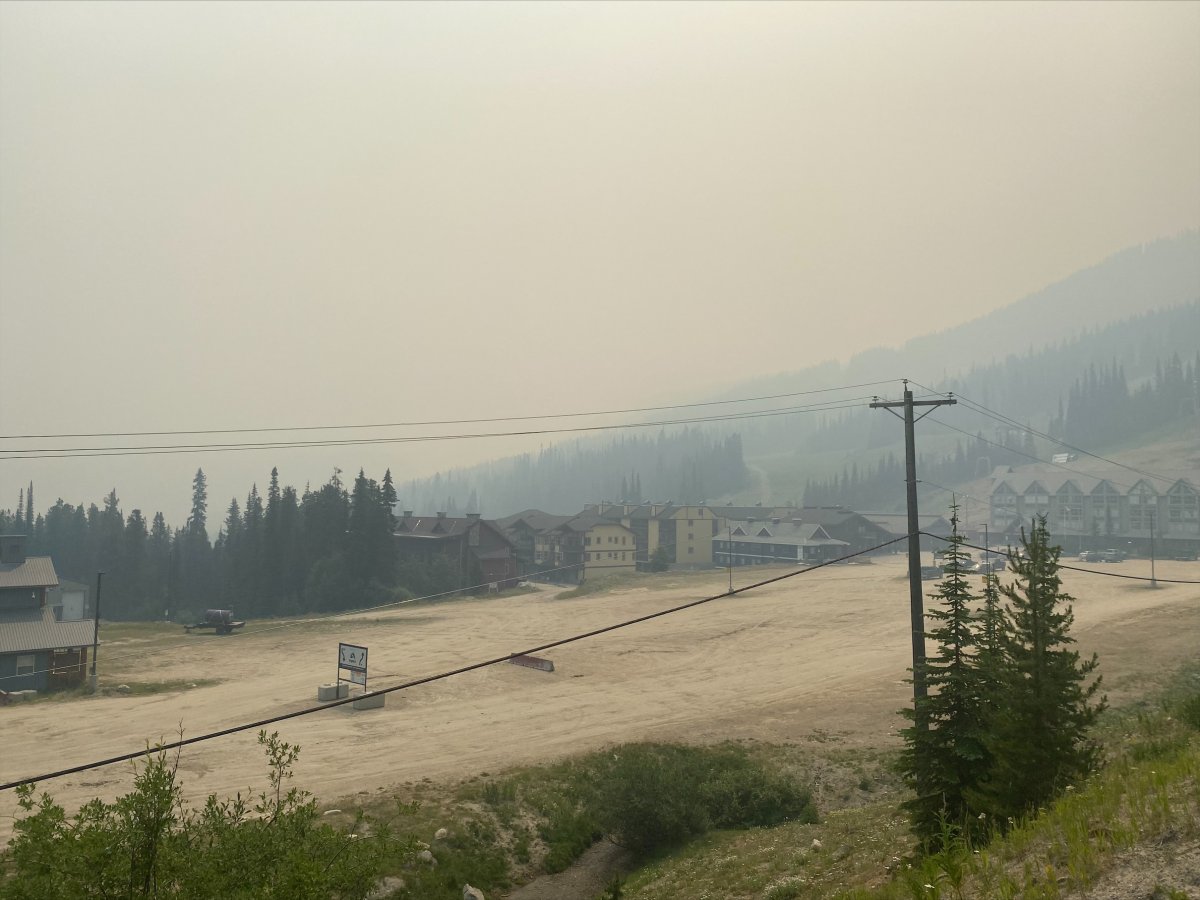
On Saturday, smoke obscured the sky in nearby Apex Village.
And just before 1 p.m., Environment Canada issued a special air quality statement for Penticton, Summerland, Naramata, Keremeos, Oliver and Osoyoos.
“Wildfire smoke is a natural part of our environment, but it is important to be mindful that exposure to smoke may affect your health,” the national weather agency said in its bulletin.
“People with pre-existing health conditions, respiratory infections such as COVID-19, older adults, pregnant women and infants, children, and sensitive individuals are more likely to experience health effects from smoke exposure.”


For the South Okanagan, the province’s air quality health index (AQHI) had the region in moderate health risk status with a rating of four.

Get daily National news
The AQHI is based on a 1-10-plus scale — with 1-3 considered low risk; 4-6 considered moderate risk; 7-10 being high risk; and 10-plus being very high risk.
More information about wildfire smoke forecasting can be found on the website Firesmoke.ca.

The smoky skies bulletin is in addition to an ongoing heat warning that’s only in effect for the South Okanagan, but most of the province.
From Vernon to Osoyoos, wildfires aside, sunny skies and temperatures of 35 to 40 C were in the forecast for Saturday and Sunday.
“A strong ridge of high pressure continues to bring a heat wave to British Columbia this weekend,” said Environment Canada. “A gradual cooling trend is expected early next week. Current guidance indicates temperatures returning to seasonal normals on Tuesday.”
- Retired Quebec teacher buys winning lottery ticket at last minute, wins $40M
- N.B. election: Higgs went to ‘very dark place’ with Liberal joke, opponent says
- NDP want competition watchdog to probe potential rent-fixing by landlords
- Jasper mayor says CN Rail relocation will be devastating: ‘Deeply disappointed’


Comments