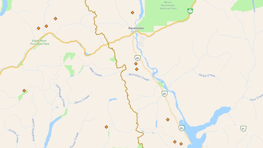
Seven wildfires are burning around the Revelstoke area in B.C.’s Interior as of Saturday morning.

They’re part of a large swath of fires following overnight lightning on Thursday and early Friday that rolled across the Southern Interior. In fact, according to the B.C. Wildfire Service (BCWS), there were 3,995 lightning strikes during that span.
The majority hit the Kamloops Fire Centre, with the remainder in the Southeast Fire Centre, which includes Revelstoke, plus the Cariboo and Prince George fire centres.
All fires were spot-sized, according to BCWS data on Saturday morning, though updates are expected later in the day.
The closest fire to Revelstoke, the Frisbee Ridge blaze, is around six km to the north. It was sized at 0.10 of a hectare.

Get breaking National news
Heading 11 km southwest of Revelstoke are two fires (Mt. Begbie 1 and Mt. Begbie 2) that are two km apart. The two are in rugged terrain, around 3.5 km from the western shores of Upper Arrow Lake.

Continuing south along the shores of Upper Arrow Lake, the Cranberry Creek fire is listed at 0.03 of a hectare. It’s located 12 km northwest of Shelter Bay.
And due west of Shelter Bay are two more fires. The Bannock Creek fire (0.01 ha) is 3.5 km away, while the Hall Mountain fire (0.66 ha) is six km away.
Lastly is the Gagney Creek fire (0.01 ha), which is 36 km to the southwest, and is located in the Kamloops Fire Centre. It’s also around 32 km west of Shelter Bay.


Comments
Want to discuss? Please read our Commenting Policy first.