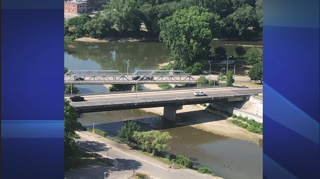
The Upper Thames River watershed in southwestern Ontario is experiencing Level 1 low water conditions, according to the local Low Water Response Team.

In a release, the Upper Thames River Conservation Authority (UTRCA) said the watershed received an average of 17 mm of rain between June 15 and July 15, which is about 22 per cent of what it typically receives.
Precipitation over the last three months, between April 15 and July 15, was around 58 per cent of average.
Stream flows across the watershed are also below average for this time of year and are expected to drop further due to the ongoing lack of rainfall.
The Level 1 advisory is part of a three-tiered system of local low water conditions.

Get breaking National news
“We evaluate low water conditions by looking at several indicators, including precipitation and stream flows,” said Mark Helsten, the senior water resources engineer with the UTRCA.
The UTRCA has three large reservoirs and several smaller ones across the watershed.
The large reservoirs at the Pittock and Wildwood conservation areas in Woodstock and St. Marys, respectively, provide flow augmentation in the summer by storing spring runoff and then slowly releasing the water back into the river system in the dry summer months, the release said.
This spring, the two reservoirs both reached their target summer elevations.
The stored water is currently being released to increase downstream flows in the North and South Thames Rivers.


_848x480_1514509379939.jpg?w=1200&quality=70&strip=all)


Comments
Want to discuss? Please read our Commenting Policy first.