

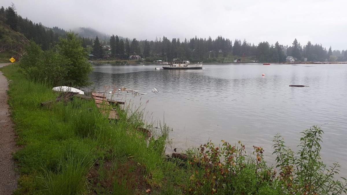
With water levels increasing in B.C.’s Shuswap region, the area’s emergency operations centre has been activated.

According to the Columbia Shuswap Regional District (CSRD), the water level in Shuswap Lake was at 348.581 metres on Monday morning, up 5.3 cm from Sunday morning when it was listed at 348.528 metres.
“The Shuswap Emergency Program has activated its emergency operations centre to assist with flood preparations in the Shuswap, as both river and lake levels are increasing,” said the CSRD.
The regional district says it will be posting lake levels daily during the flood watch period.
For context, the CSRD gave lake levels from previous flood years.

Get breaking National news
- 1972: 349.660 metres
- 2012: 349.588
- 2018: 349.141
Find the CSRD’s daily lake levels on their webpage.
In related news, the City of Enderby says its emergency operations centre is monitoring local flood conditions, and is encouraging residents who live in flood-prone areas to take measures to protect their property.

It also said the water height for the Shuswap River is at 4.77 metres (14.65 feet), and had a discharge rate of 450 cubic metres per second. That’s down from Friday, when the readings were 4.84 metres (15.88 feet) and 462 cubic metres per second.
- Calgary maintains rules for backyard suites but secondary suites will get ‘automatic approval’
- B.C.-designed dive suit to be showcased at the Pentagon
- B.C. minister says TransLink must find way to transport HandyDART passenger
- Kelowna moves forward with plan to protect land for potential Highway 97 widening


“Warm, dry conditions are forecast throughout today and into tomorrow, with a chance of showers for tomorrow afternoon,” said the City of Enderby.
“Forecast models are predicting that the Shuswap River discharge rate will continue to rise throughout the week, with a discharge rate of 473.3 (cubic metres per second) predicted for Friday.”
The city also said closures remain in effect for Riverdale Drive, Kildonan Boat Launch, and Tuey Park, and that sand and sandbags are available for free at the Public Works Yard at 2308 McGowan St. Residents will have to bring their own shovels.

The B.C. River Forecast Centre has placed the Shuswap, and parts of the North Okanagan, as being in flood watch territory.
Under a flood watch, the River Forecast Centre says river levels are rising and will approach or may exceed bankfull. Flooding of areas adjacent to affected rivers may occur.
Comments
Want to discuss? Please read our Commenting Policy first.