Spring flooding has forced communities in the western provinces of Canada to declare states of emergency and evacuate residents.

Excessive rainfall at the beginning of May has caused severe flooding, particularly in Manitoba and Alberta, where thousands have been forced out of their homes.
Global News’ chief meteorologist Anthony Farnell said flooding often happens in Canada, but global warming is “making it a bit more extreme.”
Intense rainfall is caused by warming and an increasingly volatile climate. Add in decades of the paving of wetlands and forests — considered nature’s sponges — and you have all the ingredients for catastrophic flooding in Canada, a United Nations report says.
The report goes on to state that flooding is the most frequent and costly natural disaster in Canada. For instance, the B.C. floods last November are still on track to become the most expensive natural disaster in the province’s history, costing the federal government a historic $5 billion. The total cost however is likely to be much higher as officials continue to assess the scale of the destruction.

With global warming not slowing down, the conversation on climate is being focused on how people and cities can live with climate change as it happens.
Here’s a look at what’s happening in each of the provinces affected by spring flooding and how some communities are being impacted.
Manitoba
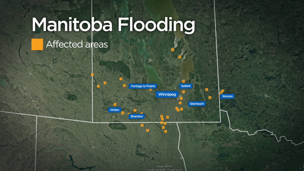
Manitoba will continue to reckon with spring flooding as another two or three storms are expected to hit in the next 10 days, said Farnell.
Since the end of April and early May, communities across the province have been battling the high waters of the Red River and its tributaries.
“It’s been such a wet spring … and even though we may not see worse flooding, it’s going to take a long time to get better,” said Farnell.
Among the many other communities affected by floodwaters, the town of Arborg — 100 km north of Winnipeg, in the Interlake region — has a major intersection underwater and some flooded homes in the surrounding Rural Municipality of Bifrost.
The hardest-hit area is Peguis First Nation, 160 kilometres north of Winnipeg, where some 1,800 people have been evacuated from homes surrounded or flooded by the swollen Fisher River. The water level of the river has dropped in recent days, but with more rain in the forecast this week it is likely to rise again.
“One thing about both the Red River Valley and the Red River, particularly through Winnipeg and much of southern Manitoba … is that it does tend to flood every few years. But this, I think, is the worst that they’ve seen in at least a couple of decades,” said Farnell.

Get daily National news
He said there’s not much that can be done, adding that these rivers tend to change course.
“When we have developments in cities like Winnipeg, right on the banks of these rivers, then it doesn’t have the ability to change course. The whole water just flows from point A to point B, and in some cases, it just submerges everything. And that includes things like infrastructure, such as highways, which are now underwater in parts of Manitoba,” Farnell explained.

Alberta
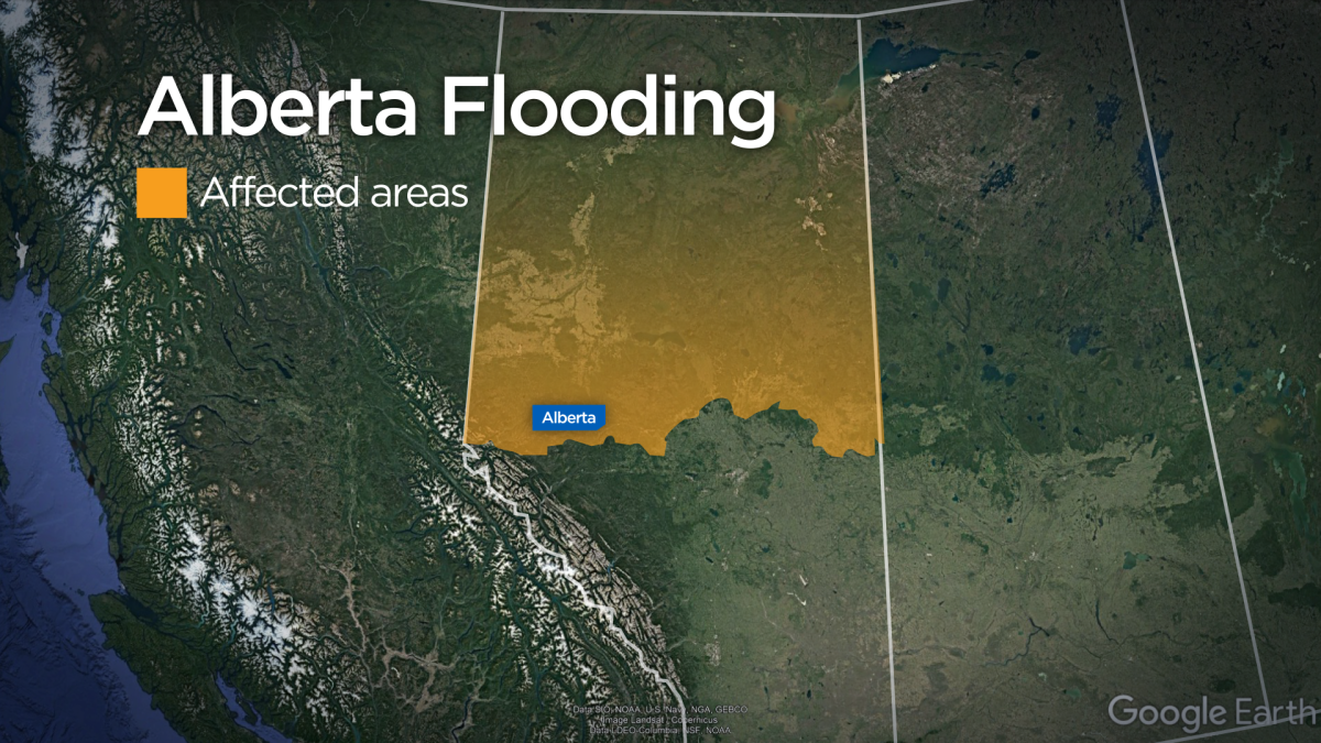
Flooding in northern Alberta this week has prompted three communities to issue a local state of emergency, which led to residents being asked to evacuate.
These communities include the Paddle Prairie Métis Nation Settlement, Chateh and Little Red River Cree.
Precipitation and snowmelt have led to flooding in that area, provincial officials said.
A flood warning was also issued for the Sousa Creek last Friday, with waters expected to rise over the next four to five days.
As of May 9, more than 1,000 people have been affected by the flooding.
 Water levels appeared to have peaked, and the province said on Monday that with continued snow melt and saturated soil, waters are not expected to recede for days. They said it could be months before many evacuees return home.

Northwest Territories
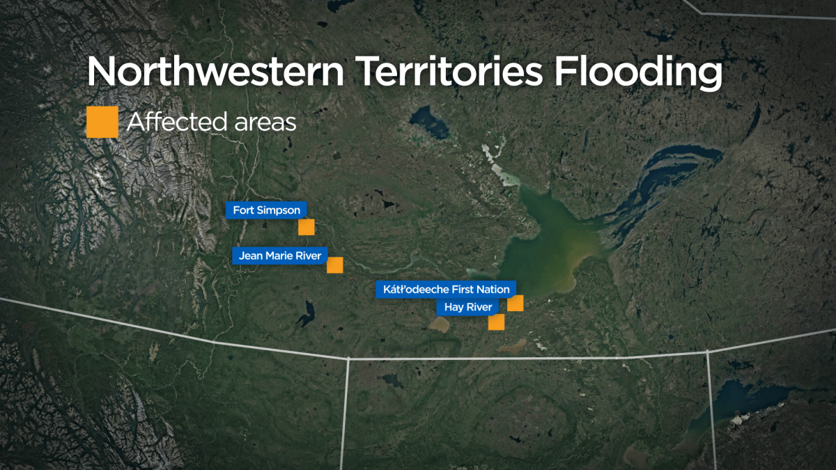
An evacuation order was issued for the entire Northwest Territories town of Hay River late on Wednesday as floodwater reached the community’s downtown area.
Chief April Martel of the neighbouring K’atl’odeeche First Nation ordered her entire community to leave and head for the community of Enterprise, south of Hay River.
Some 4,000 residents overall have been affected.
Residents of Hay River were told to head for higher ground or to the town’s community centre. Yellowknife opened its multiplex as an evacuation centre for people leaving Hay River by road in search of safety.
In Fort Providence, the Big River gas station assisted evacuees through the night.
There were reports of power outages in parts of Hay River as the water rose. On Wednesday evening, the Department of Infrastructure had declared the only road link to the town’s Vale Island impassable and closed it off.
The Town of Hay River asked anyone that had left their home but not registered as an evacuee to call 1-833-699-0188 for assistance.
Mikey McBryan, the general manager of N.W.T. airline Buffalo Airways — which maintains a base in Hay River — said the town’s airport, which is on Vale Island, had been shut down.
The first signs of further trouble came on Wednesday evening when a section of ice broke away outside the First Nation and a nearby bridge appeared to be in danger of flooding. The break sent a fresh surge of water toward Hay River.

Multiple residents reported being rescued from downtown homes by boat. The Whispering Willows seniors’ facility was being evacuated as floodwater reached the rooms.
Hay River’s Old Town areas like Vale Island were long considered to be at risk of flooding, which was one reason for building the newer downtown — this sort of flood was thought to be highly unlikely in that location.
However, Hay River is essentially a miniature delta through which multiple river channels run, and conditions of the past few days have conspired to create a catastrophe.
Ice-jamming in those channels has given water nowhere to go, and a weekend of rain and snow in the river’s basin ensured more and more water cascaded into that system.
“There was a large volume of ice, a large volume of snow in the basin over winter, and then this storm hit — initially as rain, which then flowed directly into streams and creeks, bumping up the water level immediately — and it parked over the entire basin,” GNWT hydrologist Shawne Kokelj said earlier this week.
“Now what we’re seeing is there’s still high water coming from farther upstream because a lot of rain fell there, too, and now some of the snow is melting and so keeps feeding a lot of these smaller streams.
– with files from Global News’ Krista Hessey The Canadian Press


Comments
Want to discuss? Please read our Commenting Policy first.