


After over 24 hours of off-the-chart poor air quality at a 10+ on the Air Quality Health Index, there is some relief in sight for the Okanagan in the long-range forecast as a special air quality statement continues.

A system spiraling around off the coast will keep a southerly or southwesterly flow in place, which will likely keep the smoke fairly thick through the majority of the work week ahead.
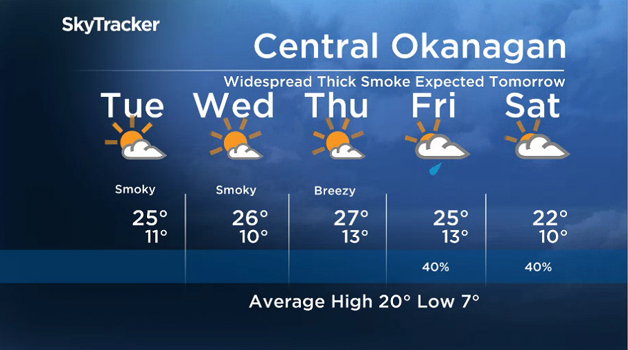
Smoke will keep temperatures cooler than their potential values with daytime highs around 23 C on Monday and 24 C on Tuesday under a mix of sun and cloud.

Get breaking National news
Mostly sunny skies return on Wednesday and Thursday with afternoon highs making it up as warm as 26 C or 27 C.
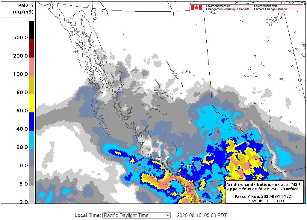


The system off the coast finally slides ashore on Friday with an upper trough that will bring in a chance of showers Friday and Saturday and cooler air, which should help flush out some of the smoke.
Daytime highs will drop from the mid-20s Friday to the low-20s Saturday and Sunday as some sunshine returns to finish the weekend.
For weather on the go download the Global News SkyTracker Weather App for iPhone, iPad or Android.


Comments
Want to discuss? Please read our Commenting Policy first.