


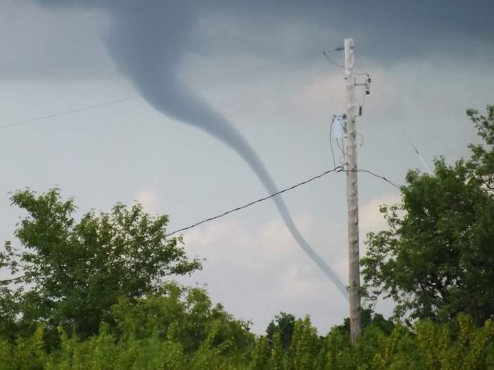
SASKATOON – Environment Canada has ended tornado and severe thunderstorm warnings in the southeast corner of Saskatchewan.

Meteorologists were tracking a trough of low pressure moving through southern Saskatchewan which triggered severe thunderstorms Saturday afternoon.
Severe thunderstorms capable of producing tornadoes were expected to develop this afternoon and into the evening.
These severe thunderstorms also had the potential to produce tennis ball size hail, flooding rain, deadly lightning and powerful winds.
Use this time to secure outdoor property and to ensure family members and co-workers are prepared to take action.

Get daily National news
Should severe weather approach, take shelter immediately.
Residents can report severe weather to Environment Canada by calling 1-800-239-0484 and email photos into saskatoon@globalnews.ca.
Want your weather on the go? Download Global News’ Skytracker weather apps for iPhone, iPad and Android.
Tornado watch ENDED for:
- Estevan – Weyburn – Radville – Milestone
- Fort Qu’Appelle – Indian Head – Lumsden – Pilot Butte
- Moosomin – Grenfell – Kipling – Wawota
- Carlyle – Oxbow – Carnduff – Bienfait – Stoughton
Tornado warning ENDED for:
- R.M. of Reciprocity including Alida
- R.M. of Storthoaks including Storthoaks and Fertile
- R.M. of Argyle including Gainsborough and Carievale
- R.M. of Mount Pleasant including Carnduff
Severe thunderstorm warning ENDED for:
- R.M. of Brock including Arcola and Kisbey
- R.M. of Reciprocity including Alida
- R.M. of Moose Creek including Alameda
- R.M. of Coalfields including Bienfait and North Portal
- R.M. of Enniskillen including Oxbow and Northgate
- R.M. of Antler including Redvers Antler and Wauchope




Comments
Want to discuss? Please read our Commenting Policy first.