
It doesn’t look like spring flooding will be as bad as had been feared in Manitoba.

In its latest flood update released Tuesday afternoon the province said the Red River crest has arrived in southern Manitoba at levels on the lower end of what had been predicted.
“We always prepare for the worst but hope for the best, and so far the weather has co-operated,” said Infrastructure Minister Ron Schuler, in a release.
“Cooler temperatures have slowed the melt and helped control high water in Manitoba, and we aren’t expecting any major spring storms in the week ahead.”
Schuler said the Red River crested in Emerson Saturday at 788.94 feet, and has since dropped to 788.7 feet as of Tuesday morning.
“This is good news as the substantial run-off we’re seeing throughout the Red River Basin will remain at the lower end of the forecast, with levels similar to those we saw in 2006 at Emerson and Letellier and levels closer to 2019 north from St. Jean Baptiste,” added Schuler.

Get daily National news
Schuler said Highway 75 will likely remain open with the help of an earthen ramp built at the north end of Morris allowing traffic to continue to use the highway.
The province says crews have been deployed to communities in the Red River Valley to close ring dikes if need be, and pumping operations are underway at most ring dike communities.
River levels are reducing in North Dakota, currently at 18.2 feet in Fargo and 35.6 feet in Grand Forks, which Schuler says means there is sufficient capacity in the channel to withstand a major storm.
“Even if we had a substantive weather event south of us it means that we would be able to handle all that water,” he said.
“It would have to be fairly epic in size to have an impact now on Manitoba and on Winnipeg.”
Crest expected in Winnipeg this week
Schuler said water levels in Winnipeg remain low with help from the Red River Floodway.
The Red was at 18.7 feet at James Avenue in Winnipeg Tuesday with the crest predicted to hit the city within the next two days between 19 and 19.3 feet James, the province said.
- A tale of 2 cities: Edmonton floods while Calgary bakes in the sun
- Sawmill closures ‘gut-wrenching’ amid lumber industry headwinds: Canfor CEO
- Global burning at record low, despite North American and European wildfires
- Judicial review request challenges denial of Corb Lund’s ‘Water Not Coal’ petition


The Assiniboine peak is forecast to reach Winnipeg Wednesday, with little or no influence on James Avenue levels in Winnipeg.
The river has cleared of ice downstream north of Winnipeg, the province says, so ice dam-related high water is no longer an issue, although a high water advisory remains in place from Lockport to Netley Creek as water levels remain high and will continue to rise as the peak moves down the river.
The floodway, which went into operation earlier this month, is currently seeing flows of nearly 20,000 cubic feet per second and the province expects the floodway will continue running until mid-May, but that could change depending on weather conditions.
The province forecasts the Red River to return to within its banks early next month.
Meanwhile Lake Winnipeg is at 714.9 feet and Lake Manitoba is at 811.4 feet, both within operating levels, the province said, and the Assiniboine River and northern rivers like the Saskatchewan and Carrot near The Pas are forecast to remain mostly in their banks.
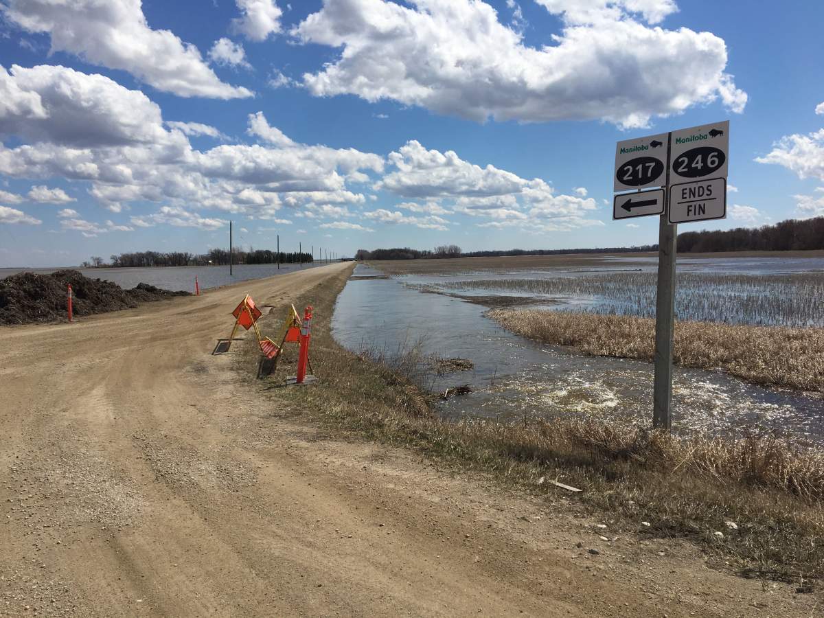
The province says a number of roads have impacted by high water levels, including parts of PR 217, PR 246, and PR 320. A list of detours and road closures can be found at the province’s website.

Comments
Want to discuss? Please read our Commenting Policy first.