The next round of snow is upon the South Coast and as always there is some uncertainty in the forecast, especially for Metro Vancouver. But here are five things that should help you navigate the next 24 hours.

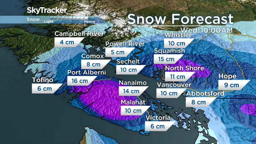
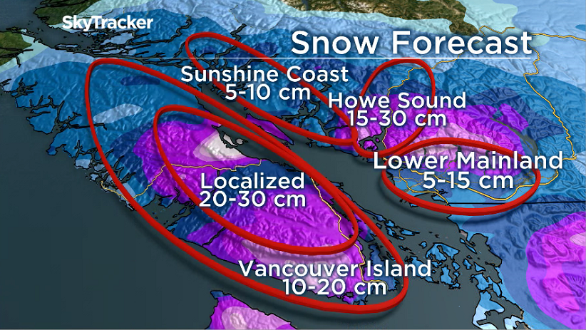
- We will see widespread snow across southern Vancouver Island, Metro Vancouver and Fraser Valley overnight. Parts of Metro Vancouver and the Fraser Valley could see up to 10 centimetres by 10 a.m., while the island could see up to 15 cm. The morning commute will likely be rough in these areas.
- There is uncertainty regarding the Metro Vancouver forecast for the afternoon hours and evening commute. Some models are showing the snow will ease, with still some flurries in the forecast, but very light. Others are showing another wave of snow into the evening commute. Adding to the uncertainty is the fact the temperature could warm to just slightly above freezing in the afternoon and the winds are expected to pick up. Global B.C. viewers are urged to tune in tomorrow for updates.

Get daily National news
Get daily Canada news delivered to your inbox so you'll never miss the day's top stories.
By providing your email address, you have read and agree to Global News' Terms and Conditions and Privacy Policy.
READ MORE: More snow expected for B.C.’s South Coast Tuesday night
- Snow will continue across much of Vancouver Island, Howe Sound and the Sunshine Coast in the afternoon. Howe Sound, inland regions of Vancouver Island and some areas along the east coast from Duncan to Comox could receive up to 30 cm by the end of Wednesday.
- Some areas right near the water on Vancouver Island, such as Victoria, could see a change to wet snow or rain as temperatures warm up in the afternoon.
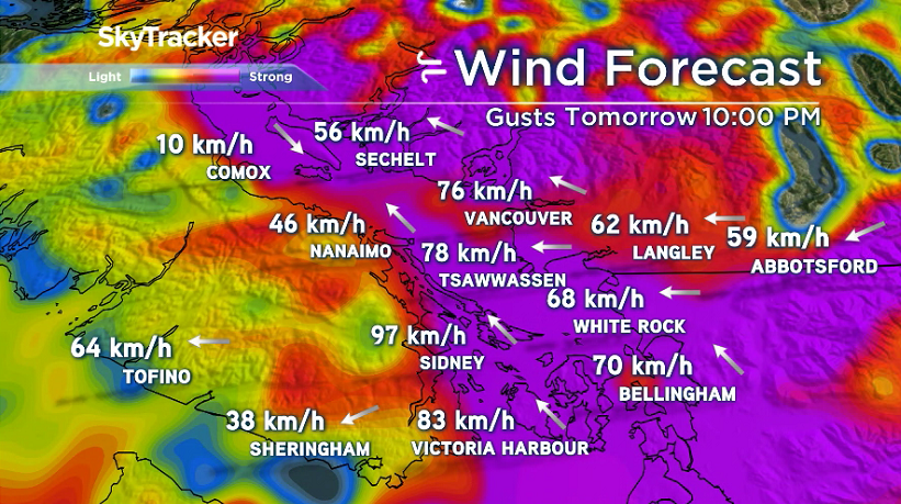
- The next big issue we are watching is the potential for damaging winds tomorrow evening for Metro Vancouver, Fraser Valley, Howe Sound, Southern Gulf Islands, east Vancouver Island, Greater Victoria and the Sunshine Coast. The winds will begin to pick up in the afternoon, but the strongest winds are expected sometime in the evening. Gusts could reach 100 kilometres per hour in Howe Sound and 70 to 90 km/h in the other regions.


Comments
Want to discuss? Please read our Commenting Policy first.