
A fresh blanket of snow started the first week of December in the Okanagan with a few centimetres reported by morning.

Sub-freezing temperatures started the day as precipitation shifted to liquid form by mid-morning as the mercury rose toward and eventually above freezing.
Pockets of precipitation linger through the afternoon and evening as conditions cool back below freezing overnight.
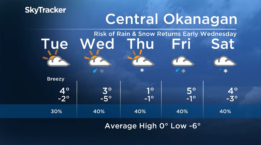
Mostly cloudy skies return to the region on Tuesday with a slight chance of showers at times during the day as temperatures climb back into mid-single digits.
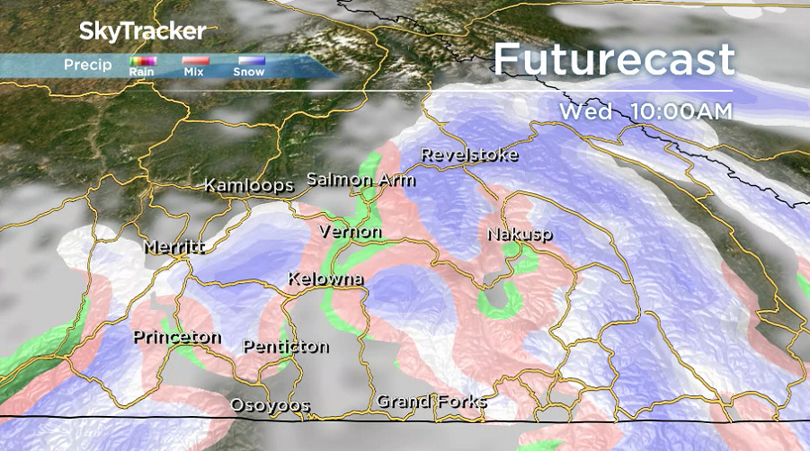
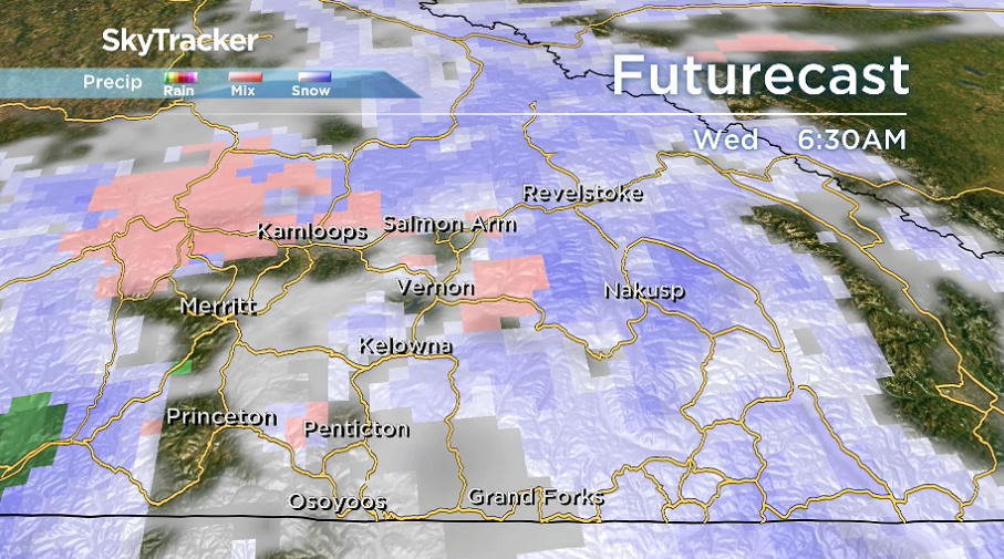
A system passing through the Interior on Wednesday will bring back a chance of mixed precipitation during the day as the valley bottom gets back up to 3 degrees in the afternoon.


Yet another wave of clouds rolls in on Thursday with temperatures around the freezing mark and a chance of flurries later in the day before a rain-snow mix lingers into the rest of the week and beyond.
Daytime highs should manage to make it back into mid-single digits with overnight lows falling a few degrees below freezing.
For weather on the go download the Global News SkyTracker Weather App for iPhone, iPad or Android.
- ‘Shock and disbelief’ after Manitoba school trustee’s Indigenous comments
- Canadian man dies during Texas Ironman event. His widow wants answers as to why
- Several baby products have been recalled by Health Canada. Here’s the list
- ‘Sciatica was gone’: hospital performs robot-assisted spinal surgery in Canadian first
Comments