
Valley cloud lingered in the Okanagan and Shuswap on Thursday morning, as moist air got trapped by an inversion brought in by an upper ridge lingering across the region.

After falling to -6 C to start the day, the mercury will climb above freezing, as sunshine will kick back into full swing during the day.
Valley cloud will once again redevelop Thursday night into Friday morning, with fog patches possibly reducing visibility at times early in the day.

Get breaking National news
Temperatures will start out below freezing by a few degrees, but will reach into mid-single digits in the afternoon, as sunshine returns before a deck of system clouds arrives by the evening.

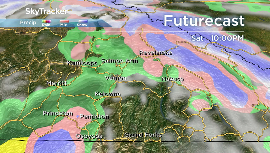
Mostly cloudy skies will linger into the weekend with a chance of showers both Saturday and Sunday, as daytime highs climb even further into mid-single digits.
Enjoy the warm weather; a cool down is on the way for the final week of November, with afternoon highs falling toward the freezing mark and a good chance of valley bottom snow next week.

For weather on the go download the Global News SkyTracker Weather App for iPhone, iPad or Android.


Comments