
After a cooler weekend behind Friday’s cold front, another one is sliding through on Monday, bringing with it a strong northerly wind with gusts in excess of 60 km/h possible into the evening.

During the day the mercury managed to climb from the freezing mark into mid-single digits by mid-morning before surging toward double digits late in the day as some clouds pass through.
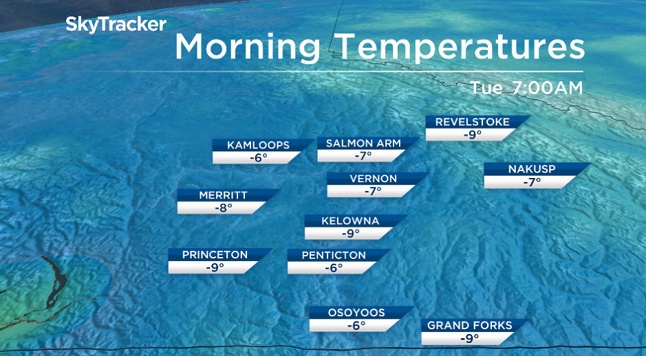
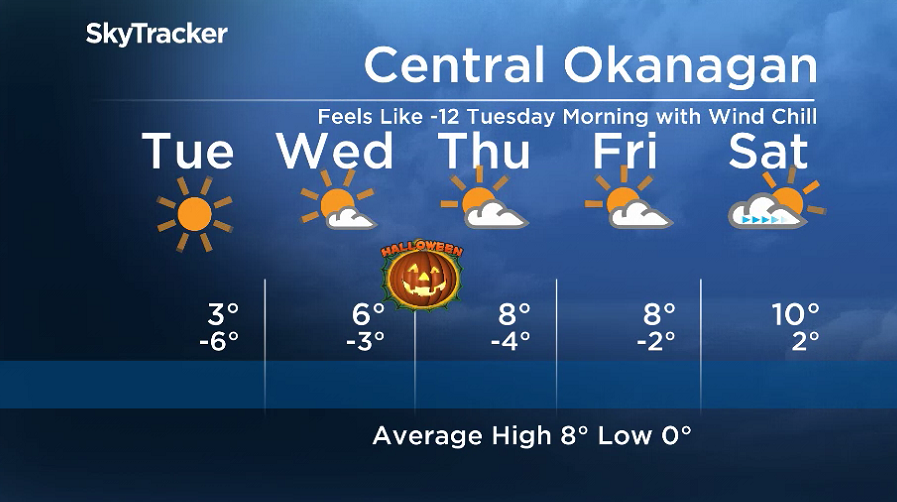
A clear night behind the cold front will bring the coldest night the Okanagan has seen in over 7 months with the mercury dropping toward minus double digits Tuesday morning, the lowest temperature seen since March 10.

Get breaking National news
Sunshine will kick back in and last all day after the chilly morning, helping boost the valley back above freezing by a few degrees in the afternoon.
Mostly sunny skies stick around on Wednesday before a few more clouds filter in early Thursday as daytime highs jump from mid-single digits into upper single digits.
- ‘Light at the end of the tunnel is very far away:’ mayor of flooded Manitoba town
- 35,000 hydro clients in Quebec, Ontario without power after severe storms
- At least 2 tornadoes reported in Saskatchewan: Environment Canada
- 13 Sask. communities in states of emergency after storms drop 275 mm of rain over 10 days


Trick-or-treaters should be ready for temperatures around -1 with wind chills around -4 Halloween night.
A mix of sun and cloud linger on Friday before clouds roll back in over the weekend with a return to double digit daytime highs.
For weather on the go download the Global News SkyTracker Weather App for iPhone, iPad or Android.
Comments
Want to discuss? Please read our Commenting Policy first.