
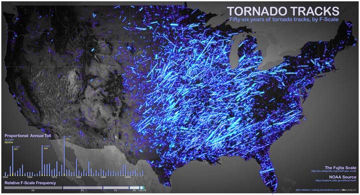
Because the Great Plains region has a high frequency of tornadoes, it has gained the unfortunate nickname “Tornado Alley.”

The United States is a vast country, which lends itself to varying climates. It is precisely these climates that create what amount to a perfect breeding ground in the southwest for violent thunderstorms, which in turn are capable of producing tornadoes.

Get daily National news
The region lies in a “dryline” that separates the dry southwest air from the moist air that comes up from the Gulf of Mexico. These two systems create instability and instability leads to thunderstorms.
Tornado alley stretches from Texas up to Iowa and encompasses the northeast part of Colorado and southeast part of South Dakota. Although this is the region that receives the most tornadoes annually, tornadoes can occur anywhere at any time of year.
More tornadoes occur in the United States than in any other country in the world.
Map source: http://uxblog.idvsolutions.com/2012/05/tornado-tracks.html


Comments
Want to discuss? Please read our Commenting Policy first.