
VIDEO: John Adams, seismologist with Earthquakes Canada, Geological Survey of Canada discusses the magnitude 5.2 earthquake felt in eastern Ontario and Quebec.

Some people had a shaky start to the morning in parts of Quebec and eastern Ontario on Friday.
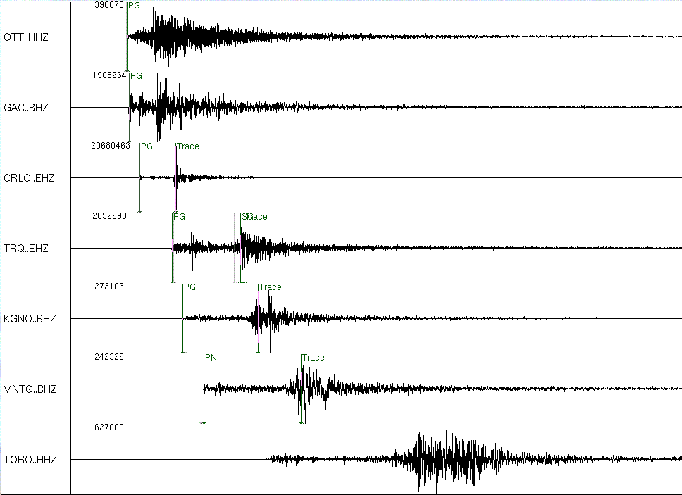
At approximately 9:43 a.m., an earthquake rocked the region. People from Montreal, Quebec, to Waterloo, Ontario, felt what was initially reported as a magnitude 4.8 earthquake. Earthquakes Canada later upgraded it to a 5.2.
“It was a sudden ‘shiver,'” said Sharmin Chowdhury who was in her office on University Avenue in Toronto when she felt the tremor. “Slight, but distinguishable… I thought it could be the subway.”
Ray Jameson of Waterloo, Ontario, said, “I was sitting at my desk when I started wavering back and forth… it lasted about 8 to 10 seconds, to my best estimate.”
On average, Canada receives 4000 earthquakes annually. However, generally only 50 are felt.
Read: A history of earthquakes in Canada
The area where Friday’s earthquake was centred is called the Western Quebec Seismic Zone.
She says that this number is an average, but the reality is we may get two or three earthquakes over a couple of years and then go many more without seeing a single major event. The most recent large earthquake was in 2010, in Val-des-Bois, Quebec. That earthquake was classified as a magnitude 5.0. This is considered a large event for the area. Based on scientific research, it is unlikely that the Quebec zone would ever see an earthquake higher than a magnitude 7.
People wonder why there are varying magnitudes when earthquakes are reported. According to Hayek, earthquakes are initially measured on a scale developed by Otto Nuttli, an American seismologist. That data is expressed as MN.

Get breaking National news
After further information is acquired, it is analyzed and another measurement is released as a “moment magnitude,” or ML. These tend to be lower than what is initially reported. Friday’s earthquake, for instance, was classified as a 5.0 on the Nuttli scale, but a 4.6 on the moment magnitude.


Although it might seem like an increase of .7 wouldn’t make much difference, the energy released in an earthquake increases by 30 times for each increase of 1 magnitude.
Earthquakes are evidence of Earth’s constant evolution. Our planet is comprised of several plates that are constantly moving. When one passes over or under another, it gives us the trembling that we feel as earthquakes. But “we’re in the middle of a plate which is pretty stable,” Hayek said. So why the area of activity?
Hayek explains that scientists have several theories. One is something called glacial rebound, where, after thousands of years of glaciers forming over Earth’s crust, it “rebounds like a sponge,” Hayek explains. There are other theories, including that the zone sits on a “hot spot” that was created when a plate shifted across the area, ending in the ocean. Another theory is that the area is on a failed plate.
“Every part on the globe is under pressure,” Hayek said.
Determining the reason the area receives earthquakes is something scientists are continually investigating.
“Research goes on,” Hayek said. “I’m confident that we’ll find out what’s happening.”
Comments
Want to discuss? Please read our Commenting Policy first.