

The final week of June, and of school, has been marked by unsettled conditions in the Okanagan.

That trend continued into Thursday, as showers and partly to mostly cloudy conditions hung about the valley, as temperatures stayed in the mid-teens except in the South Okanagan.
The mercury will manage to make it into the 20s during the afternoon, as the threat of thundershowers increases during the day as a precipitation-packed upper level low slides in.

Get breaking National news
The system will continue to push through waves of showers with up to 10 to 15 millimetres possible in thunderstorms through the evening, as temperatures slide into low double digits overnight.
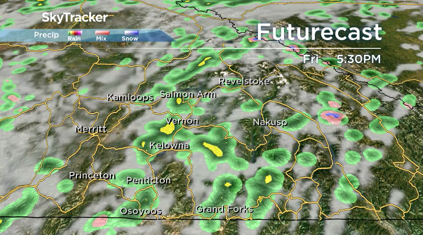
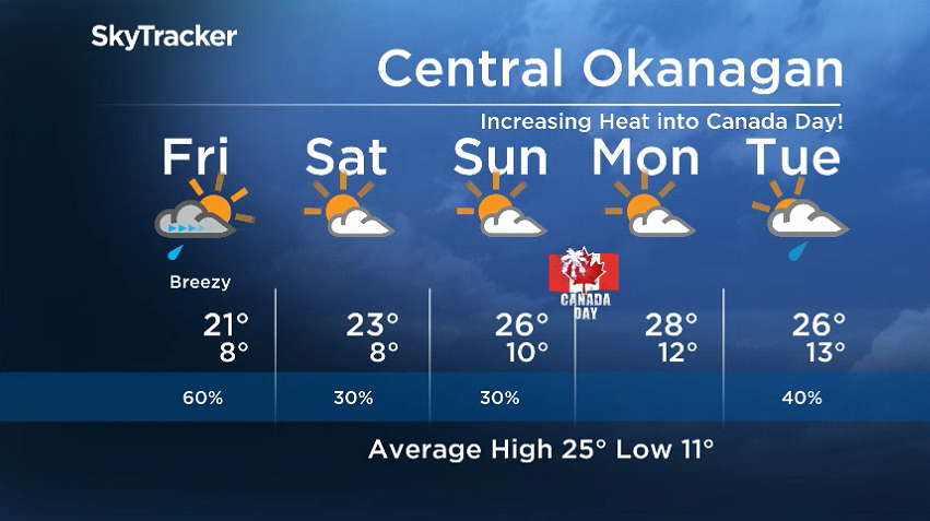
Friday will start out under partly to mostly cloudy skies with the chance of showers and risk of a storm increasing during the day, as the valley warms back into the low 20s.


The threat of precipitation diminishes as the system weakens on Saturday, with increasing sunny breaks into the day on Sunday as well, as afternoon highs settle into the mid-20s.
Canada Day on Monday is shaping up to be the nicest day of the long weekend, with a daytime high around 28 degrees under a mix of sun and cloud.
The next precipitation-carrying system and fronts sweep through for the first week of July, with a chance of showers into the middle of the week as highs jump back into the mid-20s.
For weather on the go download the Global News SkyTracker Weather App for iPhone, iPad or Android.


Comments