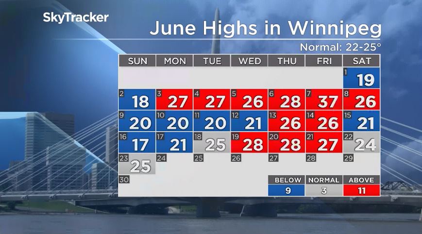
June has been back and forth with its temperatures, starting off hot and cooling off the next week and a half. This week looks like we’ll see similar temperatures to the beginning of the month, minus the near record-setting day.

While temperatures look like they’ll stay warm all week there is still some uncertainty when it comes to precipitation.
Monday, there is low pressure sitting over northern Manitoba. Getting into Monday afternoon, evening and even overnight, there is the chance of showers and potentially non severe thunderstorm activity. Thunderstorms started to pop Monday around mid day around the international border.
As you look around southern Saskatchewan, that scattered precipitation will move into southern Manitoba Monday afternoon and could carry into the overnight.
The same low pressure system is likely to move southeast for Tuesday and again, showers could pop up around southern Manitoba and again precipitation looks spotty.
Getting later into the week, the chance of showers will exist at least to a small degree. There doesn’t look to be any major rainfall events coming this week but don’t rule out the chance of seeing some scattered shower activity Wednesday or even Thursday and with the heat we’re expecting, thunderstorm activity is a possibility.
- ‘Shock and disbelief’ after Manitoba school trustee’s Indigenous comments
- Canadian man dies during Texas Ironman event. His widow wants answers as to why
- Several baby products have been recalled by Health Canada. Here’s the list
- ‘Sciatica was gone’: hospital performs robot-assisted spinal surgery in Canadian first


Comments