


Steady rainfall heading into the May long weekend helped with wildfire danger conditions across southern Alberta, however, there are still concerns.

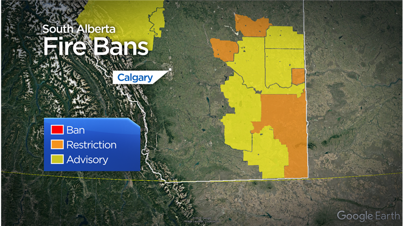
Regions east of Calgary and along the Saskatchewan-Alberta border are under fire restrictions and advisories.
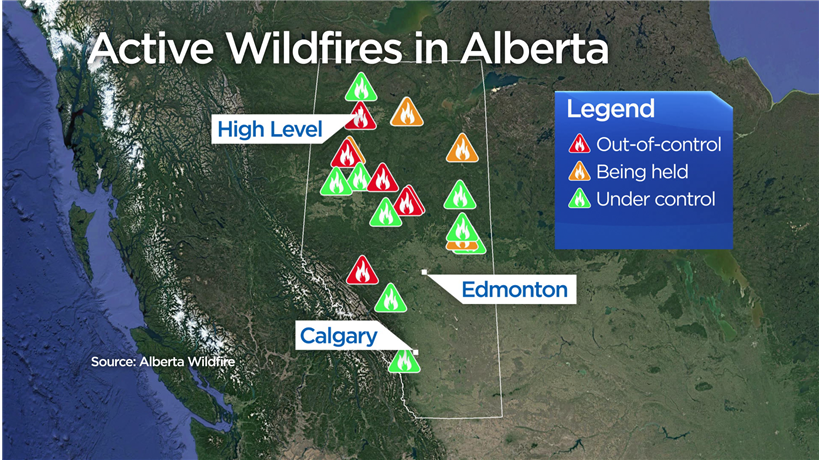
On Monday afternoon, Alberta wildfire officials were aware of 20 active wildfires burning across Alberta.
Six wildfires are considered out of control, five are being held and 12 are now under control, including a wildfire burning in the foothills west of Calgary.
READ MORE: High Level, surrounding areas evacuated as wildfire burns in northwestern Alberta
Wind blowing in from the south continues to direct wildfire smoke northward, towards the Northwest Territories as seen from satellite imagery on Sunday.

Get breaking National news
Although conditions are expected to be the same on Tuesday, forecasters are keeping a very close eye on weather patterns and the potential for a shift in winds over the next few days.

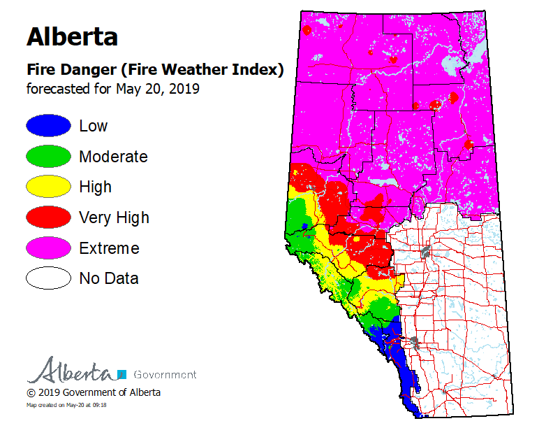
The fire danger map that was released on Monday by the Government of Alberta shows all of northern Alberta labelled as “extreme”.
Areas of moderate, high and very high danger continue to be a concern for areas in west-central Alberta.
- Old Man Winter wallops B.C.’s Mainland/Southwest region, major highway closed
- Calgary hit by unexpected blast of spring snow, causing dozens of crashes
- False spring strikes again: Saskatchewan prepares for incoming winter weather
- Albertans’ interest in alternative forms of travel growing as fuel prices spike


The province did see some rain this weekend, but not enough to make a significant difference for most of southern Alberta.
The Canadian drought monitor released at the beginning of May shows pockets of moderate drought in eastern and southern Alberta from the ongoing precipitation deficits.

Alberta Wildfire is asking the public to report wildfires to 310-FIRE and to call 911 immediately if there’s immediate danger to a nearby community.
To stay updated with radar and weather alerts in your area, download the Global News Skytracker weather app for iPhone, iPad or Android.
Comments
Want to discuss? Please read our Commenting Policy first.