
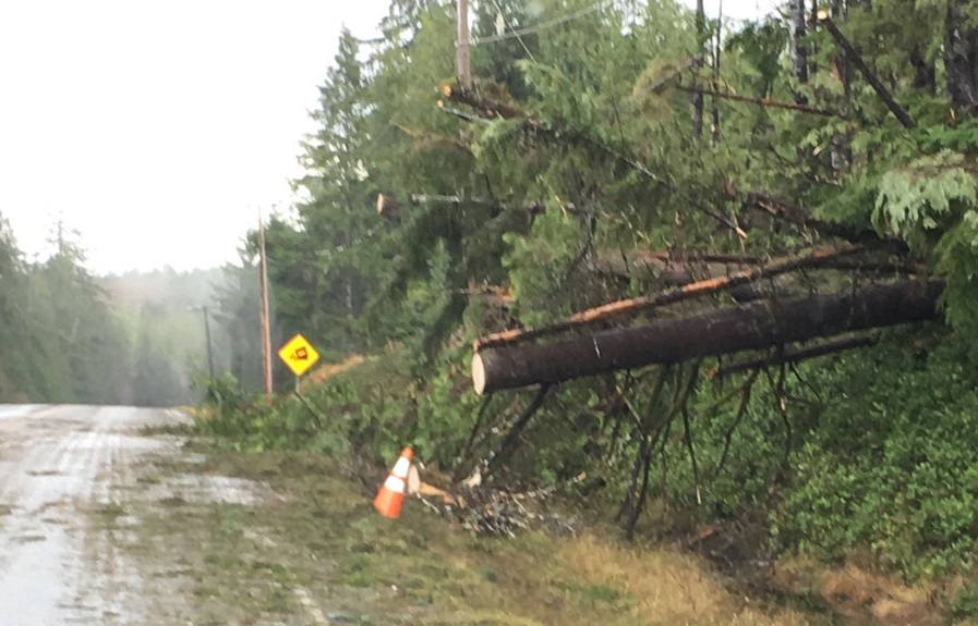
Residents of Haida Gwaii were cleaning up on Sunday after powerful winds slammed the islands hard enough to be visible on a seismograph.

On Saturday, Environment Canada issued new storm warnings for Vancouver Island, the Sunshine Coast and the North Coast, with anticipated wind speeds in Haida Gwaii of up to 120 kilometres per hour.
Environment Canada meteorologist Matt Loney said gale-force winds started up around noon on Saturday, with gusts topping out at about 130 kilometres per hour.
“The hurricane threshold is 119 kilometres per hour, so the peak winds there were above hurricane winds. Then we had another peak at about 9 p.m. … and we had 58 gusting 74 knots, so that peaked out at 137 kilometres per hour,” Loney said.
In the remote village of Cumshewa, Loney said the hardest gusts were recorded at a staggering 161 kilometres per hour.

Get daily National news
It was enough to knock out power to 1,100 homes on an archipelago with a population of just 4,700.
The winds also created shaking that was visible on Natural Resources Canada (NRCan) seismographs.


“To be fair, the seismographs are really very sensitive so they can record trains and traffic, and any ground shaking is easily recorded,” said NRCan earthquake seismologist John Cassidy.
“That diagram shows very clearly the increase in shaking over 24 hours so that’s just the wind and the waves. The wind, of course, is shaking trees and shaking buildings, the waves hitting the shore, so it is quite pronounced.”
Cassidy was clear that the shaking shown in the diagram above doesn’t rise to the level of even a small, magnitude 1 earthquake, but he said it provides a good view of how the storm ramped up as it blasted the islands.
“It wouldn’t be felt because of the way the energy builds up. With an earthquake, there’s sort of a jolting motion; there’s a really distinct wave that hits so it’s a very sharp arrival, whereas the wind shaking is a sort of gradual buildup, and it sort of drops off gradually,” he said.
Port Clements resident Jen Baily took to Twitter on Sunday to say the storm had knocked her power out for more than 18 hours and share some images of the aftermath.
Comments
Want to discuss? Please read our Commenting Policy first.