
Minus eleven is what it felt like in the Central Okanagan Thursday morning with wind chill as temperatures fell to -9, the coldest temperature recorded in over nine months, since February 23.

Lingering valley cloud stuck around through the morning before some sunny breaks started to filter in during the day as an arctic high pressure system dominates the interior.
Despite some sunshine, the mercury will remain below freezing all day, before falling back down to around -9 degrees or so into early Friday.

Get daily National news
The upper ridge will keep valley clouds around through Friday morning before skies get scoured out to bring back some sunshine and an afternoon high just shy of the freezing mark.
System clouds will filter in Friday night into early Saturday with a slight chance of morning flurries as temperatures climb up above freezing by a degree with some afternoon sunny breaks.


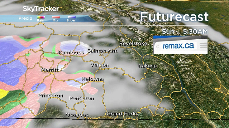
Sunday will bring on a risk of rain and snow during the day as a frontal boundary sweeps through and temperatures aim to make it above freezing by a degree or two during the day.
More precipitation is expected for the second week of December with clouds rolling in as system after system slams up against the coast and keeps daytime highs in the low single digits with a chance of rain and snow.

For weather on the go download the Global News SkyTracker Weather App for iPhone, iPad or Android.
- Retired Quebec teacher buys winning lottery ticket at last minute, wins $40M
- N.B. election: Higgs went to ‘very dark place’ with Liberal joke, opponent says
- NDP want competition watchdog to probe potential rent-fixing by landlords
- Jasper mayor says CN Rail relocation will be devastating: ‘Deeply disappointed’


Comments