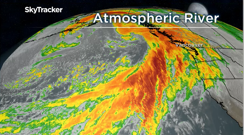
An atmospheric river targeted the South Coast Sunday night.

Heavy rain developed overnight Sunday and continued throughout Monday, leading to localized flooding and dangerous driving conditions all across the region.
WATCH: Intense storm brings wind and rain to Metro Vancouver


Get breaking National news
Rivers and streams are dangerously swollen and the fresh snow on the local mountains is getting washed away.
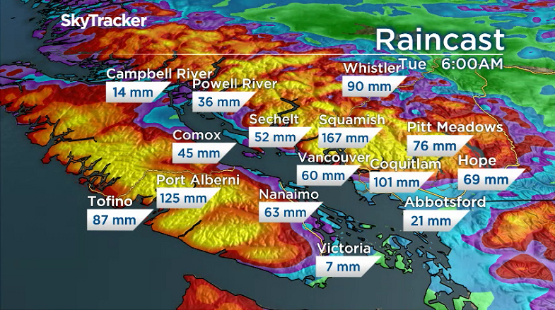
Rainfall totals will likely reach 120 mm near the mountains by Tuesday morning. Localized flooding is expected to continue until at least late Tuesday.
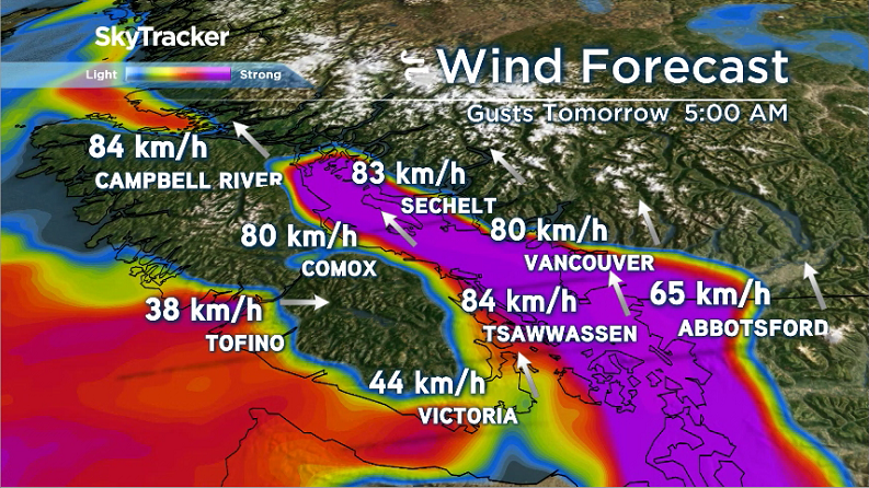
The strongest winds will occur late on Monday, overnight and through the early morning hours on Tuesday. The hardest hit areas will be along the water and south of the Fraser with southerly gusts potentially to 80 km/h. Downed trees, broken branches and power outages are a concern.
Power outages could make Tuesday’s morning commute especially slow as drivers use four-way stop procedures at intersections where traffic lights are down.
In addition, the south coast is experiencing a king tide. Rising water levels are completely submerging some areas. The next highest tides will occur Tuesday at 9:38 a.m. and Wednesday at 10:28 a.m.
#bcstorm #kingtide #burrardbridge #falsecreek #falsecreekferry #Vancouver #canada pic.twitter.com/eLGcjK2GwG
— S A Smith (@Smith442Smith) November 26, 2018
"Doggie Beach", Hadden Park. #bcstorm #sealevelrise #haddenpark #kitspoint #Englishbay #vancouver #CanadaPost pic.twitter.com/HnrI4jxfVK
— S A Smith (@Smith442Smith) November 26, 2018
Kits Pool… #KingTides #bcstorm #Canada #Vancouver #Kitsilano pic.twitter.com/Oy2IjZlnNl
— S A Smith (@Smith442Smith) November 26, 2018
Conditions will ease in the afternoon on Tuesday but some rain is expected on and off through much of Wednesday.
Please send updates and photos to weatherwindow@globaltv.com.


Comments