
After as weekend filled with beautiful blue skies, sunshine and mid-teen afternoon temperatures, big changes are on the way for the fourth week of October in the Okanagan.

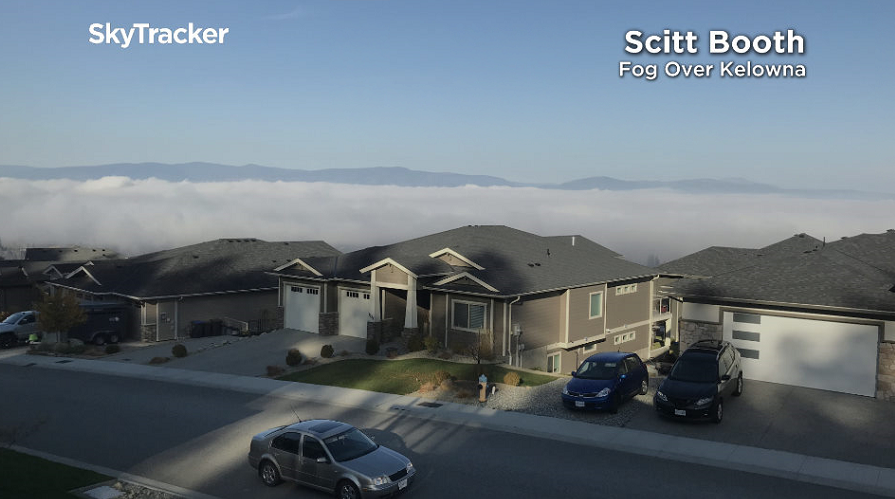
You wouldn’t know it by looking at the beginning of the week though. Thick fog dropped visibility down to 200 metres in Kelowna Monday morning as temperatures fell to -2 degrees.
On top of the fog, haze, smoke, pollution and excess particulate matter has been building in the Okanagan for the past week with a ridge of high pressure keeping the atmosphere stable and preventing it from getting its usual ventilation.
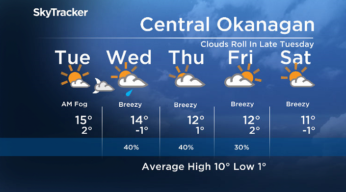
That ridge of high pressure keeps the first 2 days of the week sunny with afternoon highs in the mid-teens Monday and Tuesday.
It’ll be another cool and foggy start to the day on Tuesday as clear skies allow cool air to sink down near the warm lake, causing it to condense and mix with the moist air and create fog that will linger into the morning once again.
Once the fog clears, an afternoon of sunshine is on tap on Tuesday before clouds make their much anticipated return Tuesday evening along a cold front.
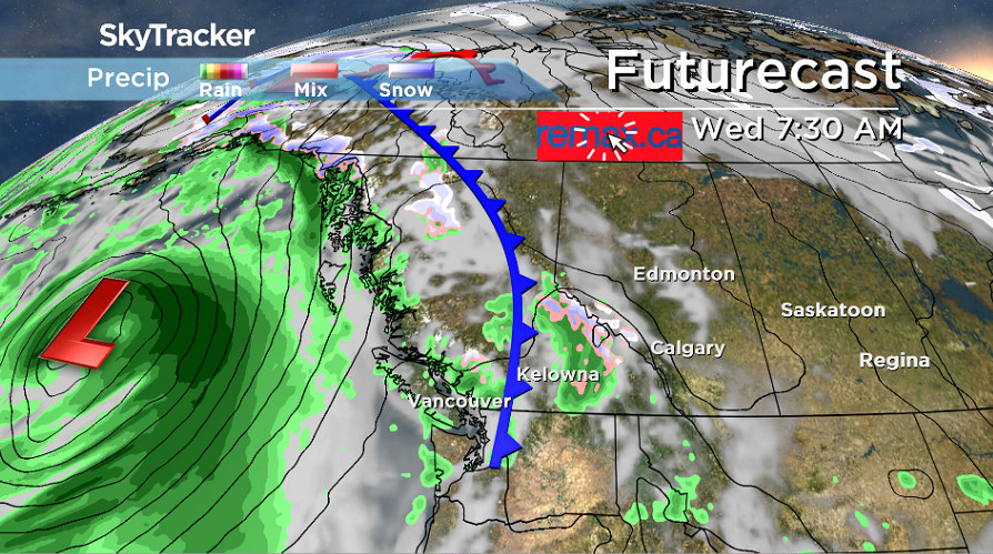
Clouds and a chance of showers will start the day on Wednesday, which will help mix out the stagnant airmass that has been reducing air quality.


Those clouds and showers will clear out, bringing in some sunny breaks later in the day with an afternoon high in the low teens.
Another surge of moisture is expected to slide in with some clouds and wind on Thursday, which will drop afternoon temperatures even further into low double digits.
Yet another wave of clouds is expected to swing in during the day on Friday with a slight chance of showers before a return to some more sunshine into the weekend.
Daytime highs will hold fairly steady in low double digits from Friday right through the weekend before likely cooling back even further next week.
For weather on the go download the Global News SkyTracker Weather App for iPhone, iPad or Android.
Comments