
It is going to be a frosty morning again Saturday with temperatures expected to drop to -4° Celsius. This will mark the first time since 5 a.m. on May 19, 2018 where Winnipeg was below the freezing mark.

Depending on when temperatures drop below 0° (Friday night or Saturday morning) it will put the streak of days above 0° at 132 or 133 which is slightly longer than normal.
According to Environment and Climate Change Canada, the average length where Winnipeg remains frost-free is 121 days with the first frost typically arriving on September 22nd — the first day of fall.

Get breaking National news
Instead of frost, on September 22, Winnipeg got snow.
September has been cool over the last week with temperatures dropping down to 1° C five times already, so the streak almost ended several times, with the earliest being Sept. 20.
RELATED: Say it ain’t snow! Northern Alberta wakes up to winter weather
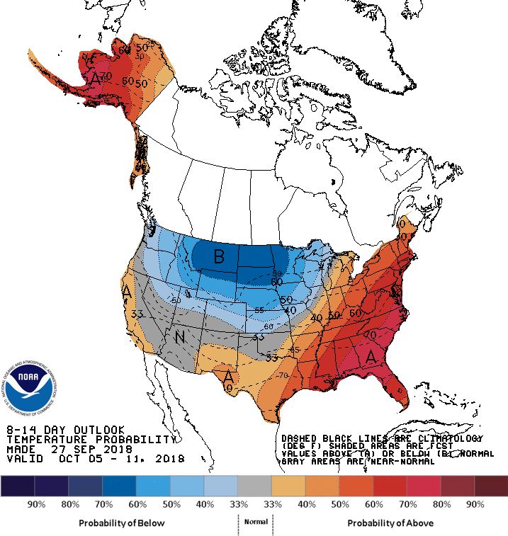
Looking forward into the longer range forecast, temperatures are likely to stay below normal. Average temperatures will continue to fall slowly in the coming days and weeks, and the long range temperature forecast from the National Weather Service in the Unites States points to cooler weather sticking around.


RELATED: A look back at what September looked like this time last year
This time of year, temperatures in Winnipeg typically range from 3° C to 15°C.
Comments
Want to discuss? Please read our Commenting Policy first.