Hurricane Florence isn’t the only storm packing powerful winds and torrential rain over the world’s oceans.
There are, in fact, 10 of them — and Florence isn’t even the most dangerous one.
Coverage of Hurricane Florence on Globalnews.ca:
Visualizations developed by Global News showed just how many there were around the globe as of Sept. 13.
Here’s a look at a few of them.
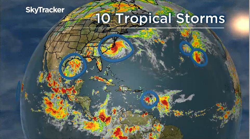
The Atlantic:
The swirl of red, yellow and green along the East Coast of the United States is Florence, a massive storm whose severity has been downgraded to Category 1 — but still packs high winds, torrential rain and storm surge.
Just south, near Texas and Mexico, is a system with no name, but that nevertheless packs a 30 per cent chance of turning into a cyclone within 48 hours.
Further south, just north of South America, is where you’ll find Tropical Storm Isaac, a system packing maximum winds of around 65 km/h.
READ MORE: Hurricane Florence has been downgraded to a Category 1 storm — but the danger’s far from over
That storm was moving through the eastern Caribbean Sea, bringing bands of rain over the Lesser Antilles, according to the National Hurricane Center (NHC).
Look to the northeast of that storm, and you’ll find two more systems.
Like Isaac, Tropical Storm Joyce is packing maximum winds of about 65 km/h.
To the east of that system is Tropical Storm Helene, which is blowing stronger with maximum winds at approximately 100 km/h.
The Pacific:
As size goes, none of these systems can hold a candle to Super Typhoon Mangkhut, which was on course for the Philippines on Thursday.
That storm, which has maximum winds of up to 255 km/h (equivalent to a Category 5 hurricane), was believed to be putting over four million people at risk.
Observers expect that the system will make landfall close to Isabela province, after initially tracking toward Cagayan.
The storm has a raincloud band that’s 900 kilometers wide — and it’s coming alongside monsoon rains, creating risks for flash floods and landslides.
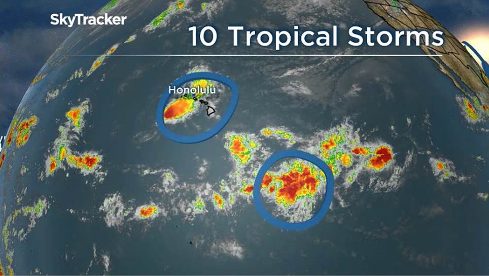
Hawaii:
Near Hawaii, Post-Tropical Cyclone Olivia is blowing with winds of over 50 km/h, but it’s moving away from the islands.
Before that, however, it was Tropical Storm Olivia, a system that was expected to bring pounding rains and flooding to Oahu and Maui.
And that was after the islands dealt with Hurricane Lane, which left Hawaii with major floods and mudslides after pounding the island for over two days.
Also near Hawaii is Post-Tropical Cyclone Paul, carrying winds of 55 km/h.
The final update on that system from the NHC came on Wednesday at 2 a.m. — at that time, it was heading west at 15 km/h.
It was not expected to threaten land any longer on Thursday.
- With files from The Associated Press and Reuters