

A risk of frost is in the forecast as rain rolls out.

Saskatoon Forecast
Monday
Light rain started the day, which helped improve the slightly smoky air quality as temperatures dipped back to a cool 7 C to kickoff the week.
Morning mist lingered when it wasn’t raining as we warmed up into the teens before noon.
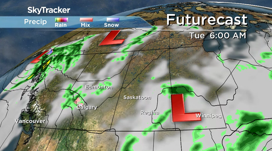
Clouds and a few more waves of rain roll through with the slight chance of an embedded thunderstorm during the afternoon as we heat up to a daytime high in the mid-teens.

Get daily National news
Monday night
Rain will ease during the evening with clouds lingering into the overnight period before starting to clear out into the early morning as we cool back to just a few degrees above freezing with some fog patches.
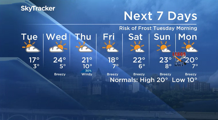
With temperatures approaching the freezing mark there is a risk of frost overnight into early Tuesday morning, so you may want to cover the tomatoes.
Tuesday
The upper trough that brought in the cool and unsettled start to the week starts to slide east on Tuesday with some lingering cloud in the morning clearing out to bring in some midday sunny breaks.
A slightly warmer day is on tap with the mercury slated to climb up to around 17 C for an afternoon high.
Wednesday-Friday
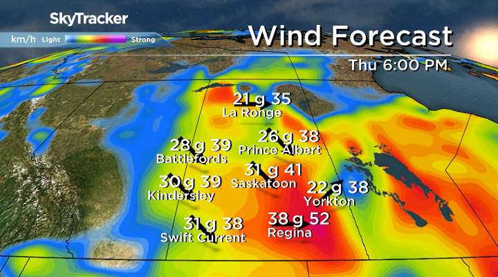
The next system destined for northern Saskatchewan slides in later this week bringing back the clouds on Wednesday that will stick around Thursday before some sunshine returns on Friday.


Gusty winds kick back in Thursday with a chance of showers and storms as daytime highs dip back from the mid-20s Wednesday back into the low 20s Thursday and further into the upper teens on Friday.
Labour Day long weekend outlook
There still is some uncertainty with the Labour Day long weekend outlook, however at this point it appears that partly to mostly sunny skies will dominate most days with daytime highs in the low 20s.
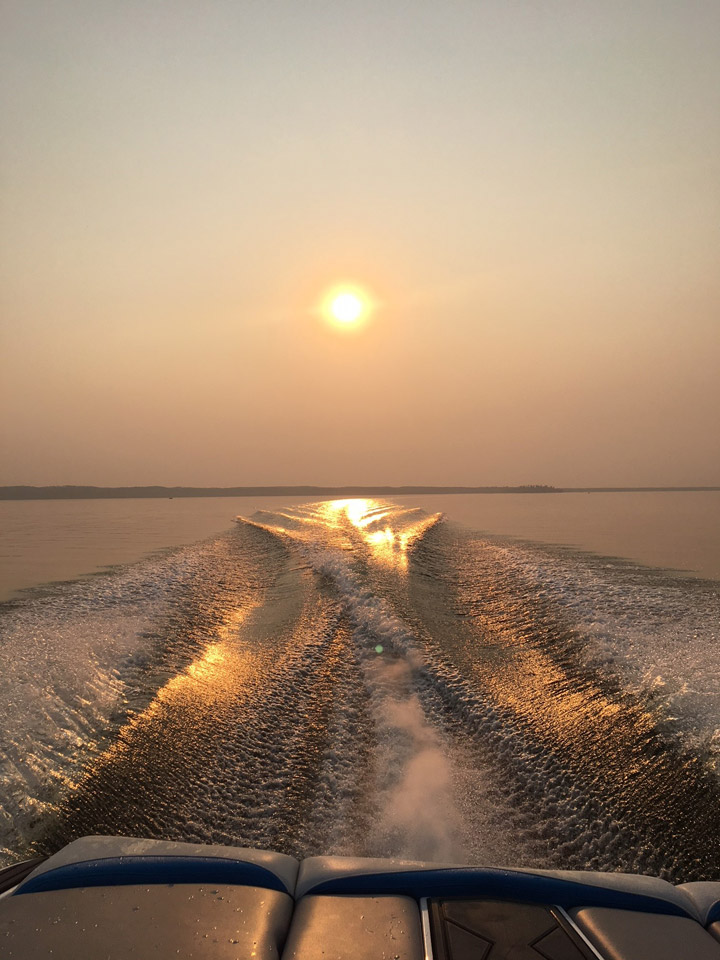
The Your Saskatchewan photo for August 27 was taken at Chitek Lake by Shantelle Missere:
Saskatoon weather outlook is your source for Saskatoon’s most accurate forecast and is your one stop shop for all things weather for central and northern Saskatchewan with comprehensive, in depth analysis that you can only find here.
Comments
Want to discuss? Please read our Commenting Policy first.