

UPDATE: All warnings and advisories mentioned in this story have ended.

Sizzling 30 degree heat comes with thick smoke.
Heat warning
A heat warning has been issued for Saskatoon, Prince Albert, North Battleford, Lloydminster and all of central and southern Saskatchewan for a prolonged heat wave with daytime highs in the mid-30s.
Overnight temperatures will remain elevated through this period giving little respite from the heat until temperatures moderate somewhat through the course of the weekend.
For the latest weather alerts download the Global News SkyTracker Weather App for iPhone, iPad or Android.
Special air quality statement
A special air quality statement has been issued for Saskatoon and across central and parts of southern and northern Saskatchewan for smoke reducing air quality and visibility.
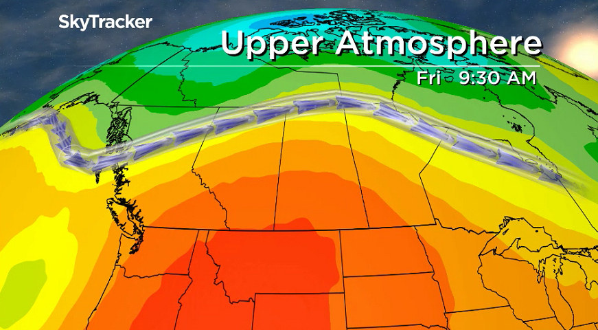
A northwesterly flow aloft is helping transport smoke from forest fires in Alberta and B.C. into Saskatchewan, which will continue into Friday and potentially this weekend.
People may experience difficulty breathing and have symptoms such as coughing, throat irritation, headaches and shortness of breath.
If you are experiencing any of these symptoms, avoid spending time outside and find an indoor space with clean air and good ventilation to spend time.

Get daily National news
Saskatoon forecast
Thursday
Smoke continued to reduce air quality to a moderate health risk in Saskatoon into the day on Thursday with some sunshine poking through as we dipped back into the low teens to start the day.
Temperatures managed to make it up into the mid-20s by late morning, which felt like 30 with humidity heading into the noon hour.
Smoke will put a damper on daytime heating with an afternoon high expected to make it up at least a few degrees into the 30s with some sunshine and humidity making it feel a few degrees hotter.
Thursday night
Smoke will continue to fill the air into the evening as we cool back into the mid-teens overnight under mostly clear skies.
Friday
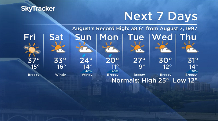
Smoke may intensify at times to a high health risk on Friday as models project another surge to swing through Friday afternoon, which may keep the city out of the historic heat models had been suggesting.
The hottest August day ever recorded was 38.6 C from Aug, 7, 1997, and while we’re expecting temperatures to make it up to 36 or 37 C, it’ll likely be just shy of that threshold despite the sunny skies.


Weekend
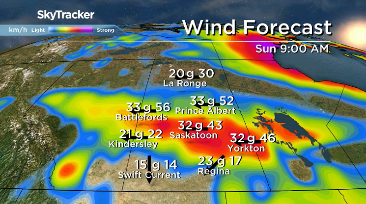
Another warm mid-30 degree day is expected on Saturday with the smoke situation starting to improve under mostly sunny skies with breezy northeasterly wind kicking in and gusting up to 50 km/h.
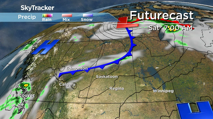
Clouds will roll in late in the day as a system swings in with a good chance of rain on Sunday under mostly cloudy skies with breezy conditions continuing as we only climb to a high in the mid-20s.
Work week outlook
Rain may linger along with the clouds on a cooler Monday with an afternoon high struggling to get into the 20s before sunshine returns mid-week along with afternoon highs rebounding into the 30s.
Global’s Meaghan Craig took the August 9 Your Saskatchewan photo at Hitchcock’s Hideaway along Lake Diefenbaker:

Saskatoon weather outlook is your source for Saskatoon’s most accurate forecast and is your one stop shop for all things weather for central and northern Saskatchewan with comprehensive, in depth analysis that you can only find here.


Comments
Want to discuss? Please read our Commenting Policy first.