

Update 3:30 p.m.

The Regional District of Okanagan-Similkameen Emergency Operations Centre has rescinded an evacuation order for four properties in the Cawston area. All of the properties remain on an advisory evacuation alert.
Original story:
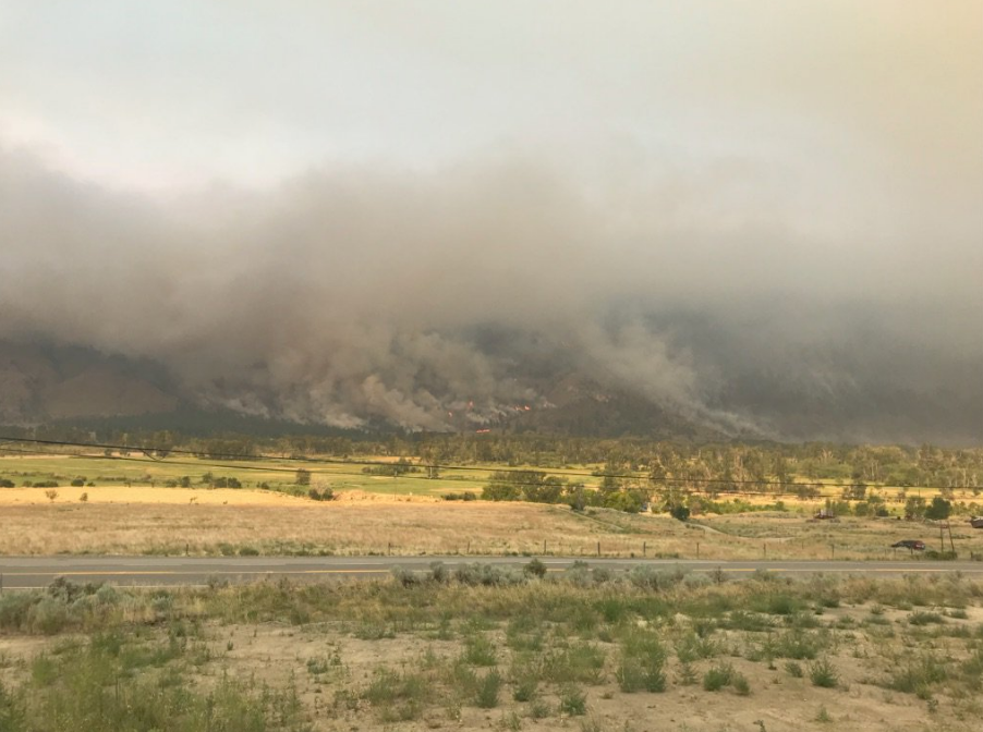
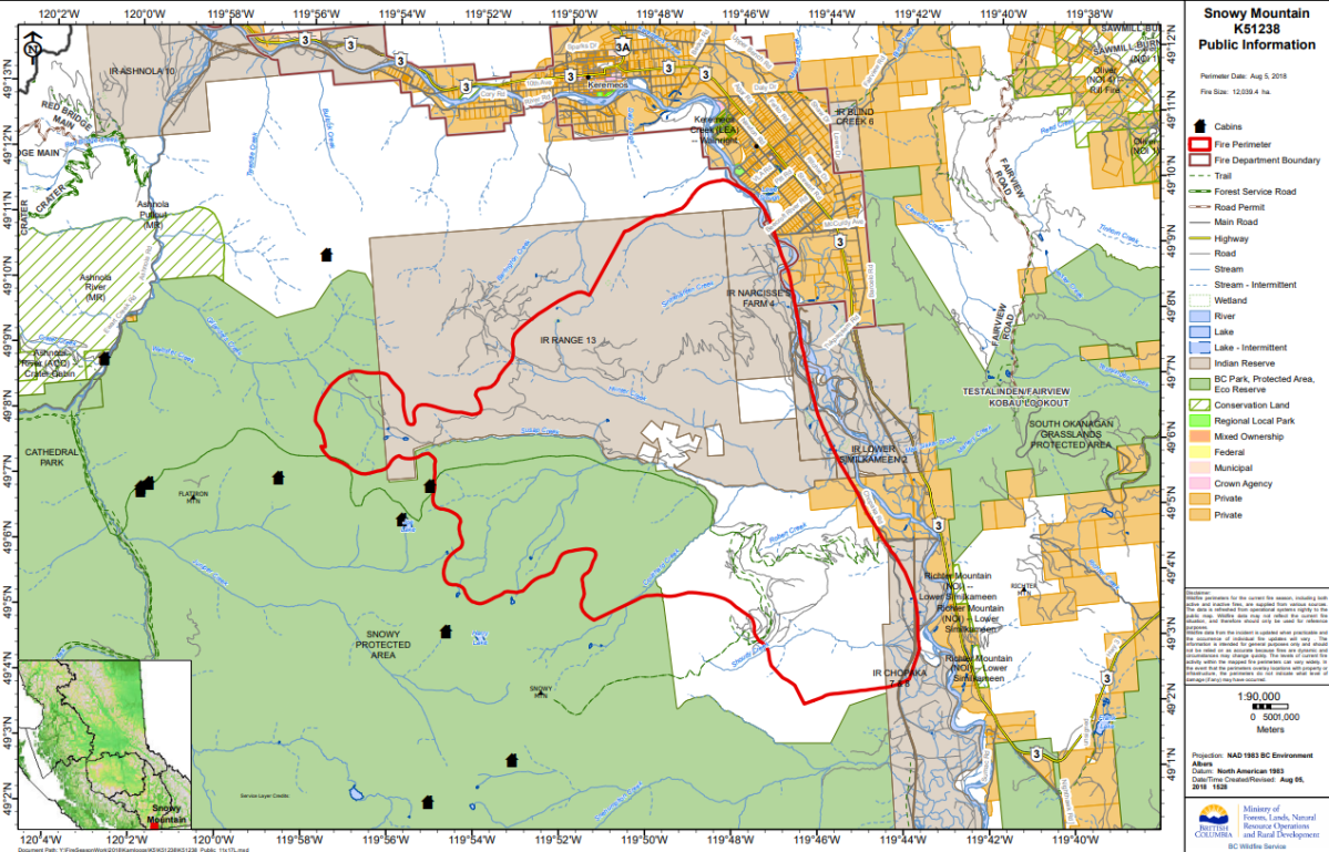
The BC Wildfire Service said the Snowy Mountain wildfire, burning 14 kilometres south of Keremeos, is now 12,039 hectares in size.
Fire information officer Claire Allen said the wildfire did not grow overnight, but improved mapping given increased visibility resulted in the updated size of the fire.
WATCH: Canadians dealing with raging wildfires and hot weather

The wind-driven fire has quadrupled in size since last week and is the largest wildfire burning in B.C.
The most visibly active part of the fire on Sunday was within a mountainous bowl and ravine on the northeast of the fire, with a smoke column noticeable from the surrounding area.

Get daily National news
On Monday, crews will work to secure the north flank and tie it into rocky slopes in order to keep the fire from wrapping around towards Keremeos.
WATCH BELOW: Snowy Mountain fire nears American border


The BC Wildfire Service said other crews will continue their work on the east flank to mop-up and patrol along Chopaka Road, and personnel will work to utilize an existing road system in the Roberts Creek area to develop containment lines.
The fire remains to the west of Chopaka Road, but is burning in a southward direction and the south flank and is approximately 3 kilometres from the U.S. border.
The BC Wildfire Service Incident Management Team said it is working with the U.S. Forest Service, U.S. Bureau of Land Management and the Washington State Department of Natural Resources given the fire’s proximity to the border.
As of August 3, the Lower Similkameen Indian Band issued an evacuation order for homes on Chopaka Road due to fire growth to the south. The order covers 21 properties.
Evacuation alerts were expanded on July 31 to include areas around Keremeos and Cawston as a precaution due to increased fire behaviour. The alert covers almost 900 properties.


Comments