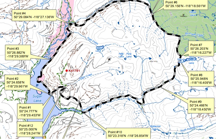
If your long weekend plans involve heading into the backcountry of the north Okanagan, you’ll want to pay attention to the new area restrictions put in place near two wildfires northeast of Lumby.

On Sunday morning, the B.C. Wildfire Service instituted new area restrictions near the Sugar Mountain and Mabel Creek wildfires.
The public is being asked to stay off of Crown land in the restricted area.
WATCH: Canadians dealing with raging wildfires and hot weather

The province said the restrictions are in place to “protect public safety, ensure the safety of firefighting personnel and deter interference with wildfire-control activities.”
The 200-hectare Mabel Creek fire has been burning since last Tuesday east of Mabel Lake.
The Sugar Mountain fire is burning east of Sugar Lake and is estimated to be 170 hectares in size. It was also first spotted last Tuesday.


Comments
Want to discuss? Please read our Commenting Policy first.