

A cold front kicks out heat and brings wind and a risk of storms this weekend.

Severe Thunderstorm Watch
Enviornment Canada issued a severe thunderstorm watch for parts of western Saskatchewan including the Battlefords, Lloydminster and Kindersley on Friday afternoon for conditions favourable for the development of severe thunderstorms capable of producing strong wind gusts and large hail.
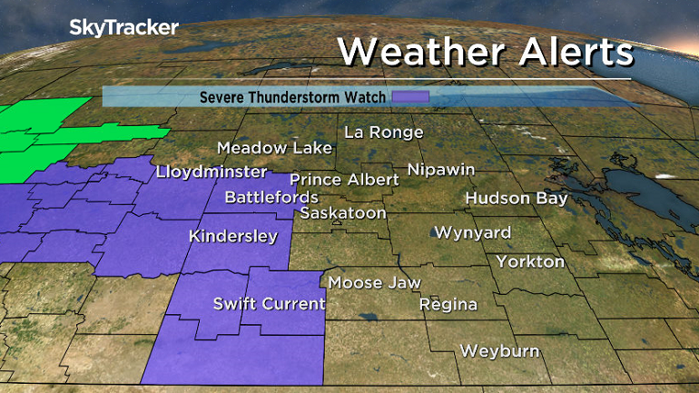
A trough of low pressure triggering thunderstorms Friday afternoon over portions of southwestern and western Saskatchewan may bring about severe storms with a primary threat of damaging hail and secondary threat of damaging wind gusts.
For the latest weather alerts download the Global News SkyTracker Weather App for iPhone, iPad or Android.
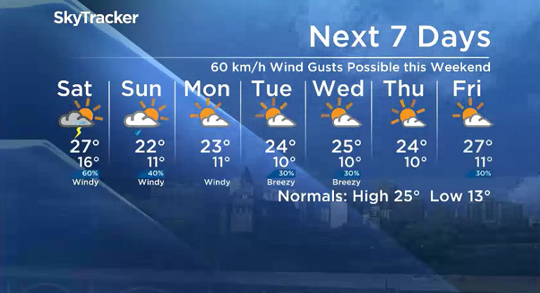
Saskatoon Forecast
Friday
15 degrees was where temperatures fell to Friday morning under mostly cloudy skies to start the day, but we quickly warmed into the mid-20s with humidex values into the upper 20s before noon.
A bit more sunshine will push in during the afternoon with breezy southeasterly winds picking up to gusts upwards of 40 km/h as we warm up to an afternoon high in the upper 20s.

Get breaking National news
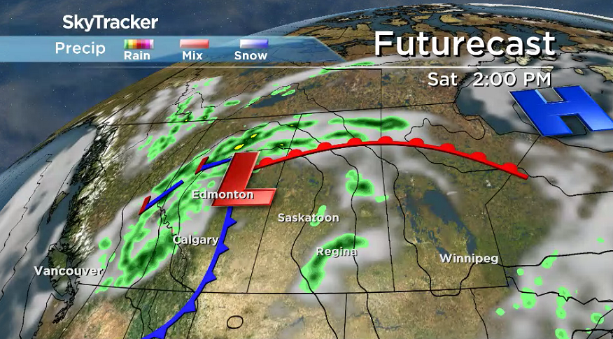
Some severe thunderstorms may roll into western Saskatchewan later in the day with the potential for large hail, strong winds and heavy rain and even the possibility of a tornado.
Friday Night
Winds will pick up even further Friday night with gusts over 50 km/h possible with some clouds and the chance of showers and risk of a thunderstorm in the evening before skies clear overnight as we cool into the teens.
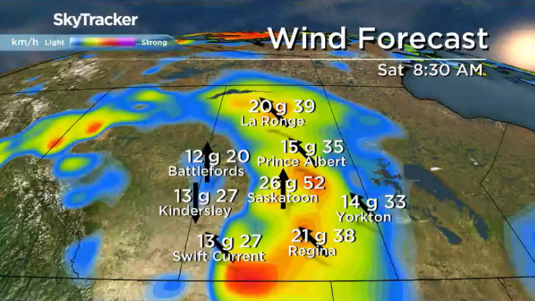
Saturday
Sunshine is expected to start things off on Saturday before clouds and a good chance of showers and thunderstorms build in during the day, lingering into the evening as a trough swings through.


Strong southerly winds will also kick in during the day up to 40 km/h with gusts over 60 km/h possible as we climb up to an afternoon high in the mid-20s, which will feel like the low 30s with humidity.
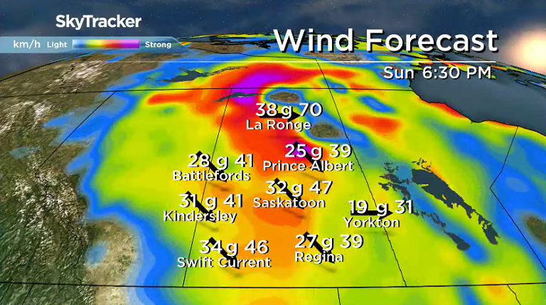
Sunday
A cold front pushing through Saturday night into Sunday will keep temperatures back into the low 20s during the afternoon as another wave of clouds with a chance of showers pushes in later in the day after some sunshine in the morning.
Winds will also be quite breezy during the day, but this time it’ll be a coo northwesterly wind with gusts in excess of 50 km/h possible.
Work Week Outlook
Winds will remain cool and brisk on Monday with some more sunshine, keeping afternoon highs in the low 20s before we gradually warm up into the mid-20s mid-week with clouds in and out and a chance of showers.
Sharon Miller took the July 20 Your Saskatchewan photo at Moon Lake:

Saskatoon weather outlook is your source for Saskatoon’s most accurate forecast and is your one stop shop for all things weather for central and northern Saskatchewan with comprehensive, in-depth analysis that you can only find here.
Comments
Want to discuss? Please read our Commenting Policy first.