

Environment Canada has issued a special weather statement for the Okanagan, Shuswap, Boundary, Similkameen and Arrow Lakes areas for a wet and cool weekend, with high elevation traveller routes seeing some snow on Sunday.

After the hottest May ever recorded across the Okanagan, with temperatures trending a whopping 5 degrees above average, a major shake up is moving in.
Rain will roll in across the region on Friday night and continue through Saturday with 10 to 20 millimetres expected, but, locally, higher amounts of 25 millimetres are possible.

Get breaking National news
Isolated thunderstorms could also bring in gusty winds and increased rainfall rates.
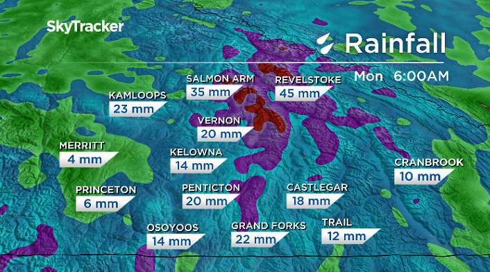
In light of the recent dry spell, with Kelowna seeing the 10th driest year on record, Environment Canada says there is a risk that increased surface run-off will cause localized flooding over the weekend.


Over the latter half of the weekend, the strong southerly flow will shift eastwards into Alberta and be replaced with a cool and unsettled airmass.
Showery conditions possibly with embedded thunderstorms will prevail on Sunday.
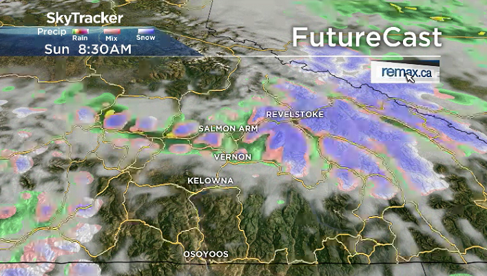
Freezing levels are expected to fall and some higher elevation travellers routes could see snow on Sunday.
For the latest weather alerts download the Global News SkyTracker Weather App for iPhone, iPad or Android.
Comments
Want to discuss? Please read our Commenting Policy first.