
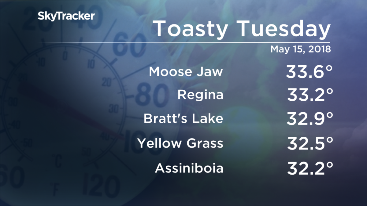
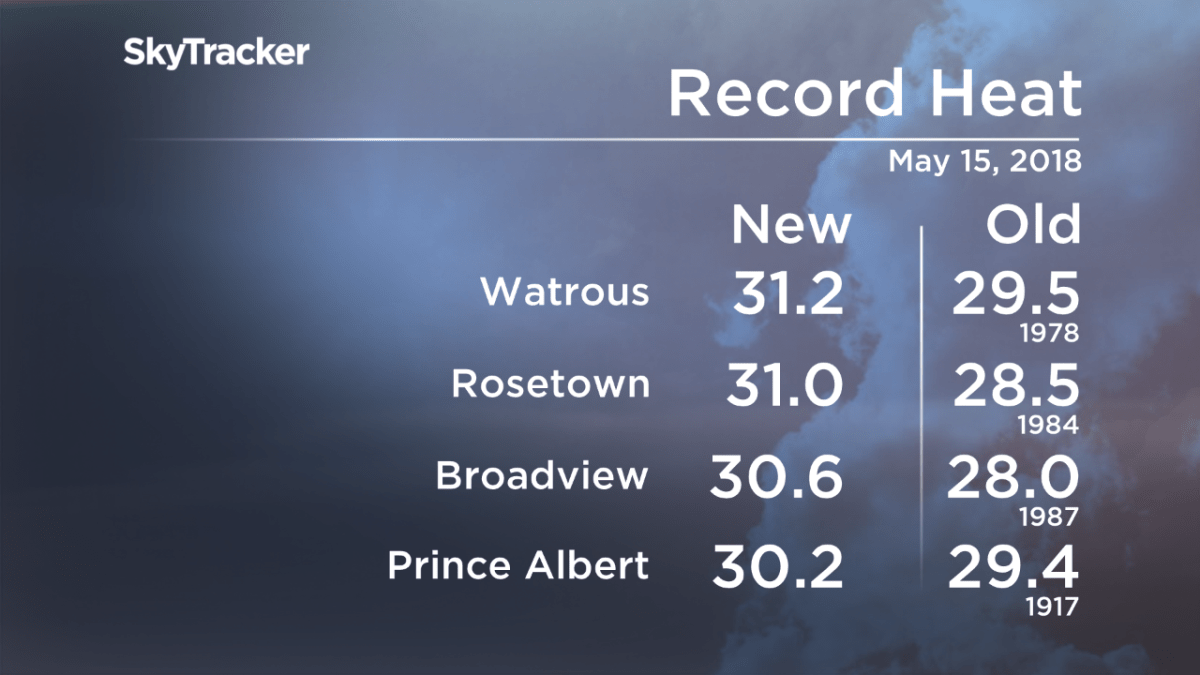
After record-breaking heat in Saskatchewan on Tuesday and a tinder dry start to the month of May, rain is finally in the forecast.

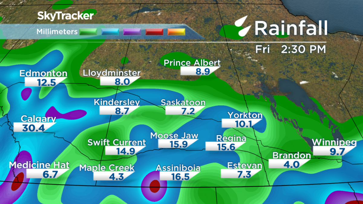
Parts of the province could see upwards of 25 millimeters of rain, and although it won’t cure the drought, it will offer some relief.


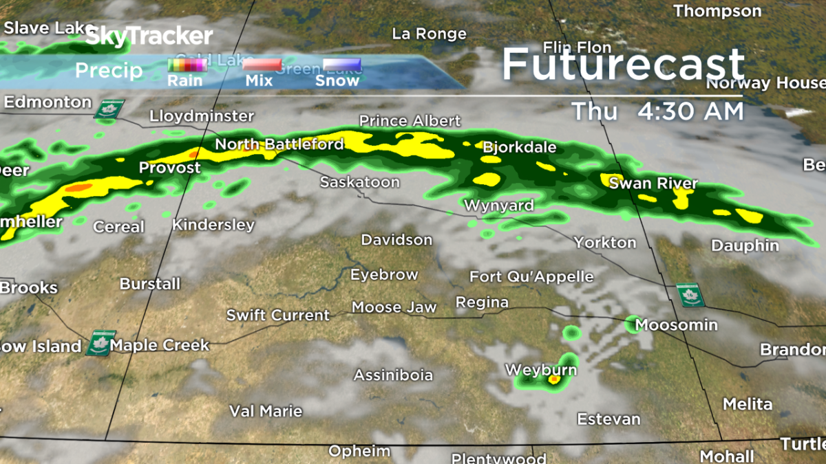
Showers will develop along the Yellowhead highway Wednesday afternoon as an upper-level system moves in from Alberta. Central Saskatchewan is in desperate need of moisture as wildfires continue to burn in the Prince Albert region.
READ MORE: Regina and area experiencing dry spell
In southern Saskatchewan, a strengthening low-pressure system will push in scattered showers and thunderstorms over the next 48-hours. The cold front associated with this system will swing through Thursday night, potentially firing off more thunderstorms before moving out of the province Friday morning.
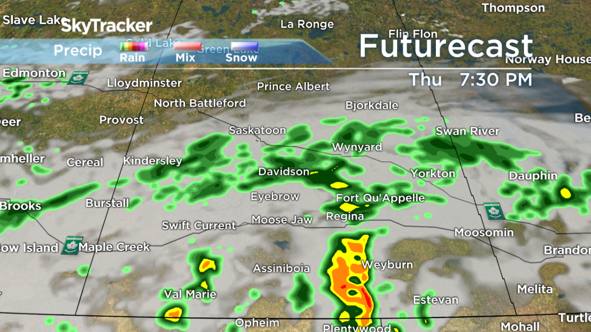
Rainfall totals from Wednesday to Friday will range from 5 millimeters to 20 millimeters, with heavier localized amounts from thunderstorms.


According to the Canadian Wildland Fire Information System, a large portion of Saskatchewan is currently under an extreme fire risk. If a wildfire were to occur in the red regions, it would be fast-spreading and very difficult to control.
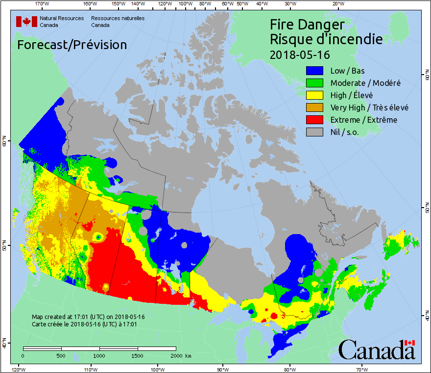
Dry conditions have forced the Saskatchewan government to issue an immediate fire ban for most of Saskatchewan heading into the Victoria Day long weekend.
Open fires and fireworks are banned on all Crown land, provincial parks and recreation sites, and burn notification areas from the Churchill River south to the U.S. border.

For weather-on-the-go, download the Global News Skytracker weather app for iPhone, iPad or Android.
Comments
Want to discuss? Please read our Commenting Policy first.