

Snow possible after temperatures pop into the mid-20s for the first time in seven months!

Saskatoon Forecast
Friday
Mid-minus single digits is what it felt like Friday morning as temperatures fell a few degrees below freezing under mostly clear skies.
Beautiful blue skies and sunshine dominated all morning with winds finally easing up as we warmed up into double digits before noon.
Sunny skies stuck around for the remainder of the day as we sat under a high pressure ridge and continued to climb up into the upper teens for an afternoon high.

Get daily National news
Saturday
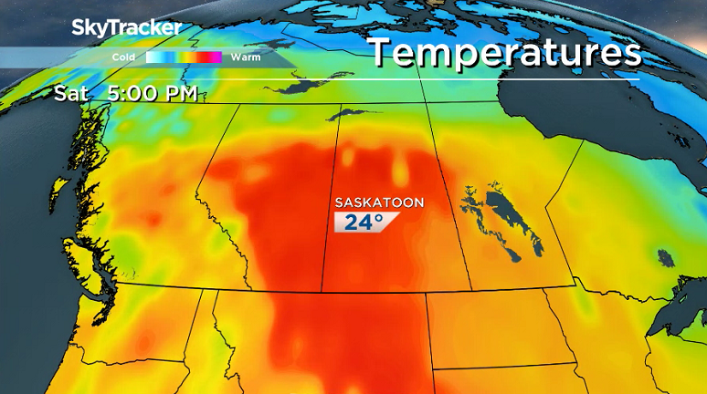
The core of the heat will be reached on Saturday with one more day of sunny skies as warm winds return from the south, reaching up to 50 km/h gusts in the afternoon as a system pushes in.
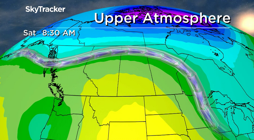
Those winds will help heat us all the way up into the mid-20s, the highest the mercury has risen in Saskatoon in seven months, since Sept. 29, 2017.
Sunday
As that system slides through on Sunday, so will the clouds, which will build in along with a strong north-northeasterly wind of 40 km/h with gusts in excess of 60 km/h as we warm up to an afternoon high in the mid-teens.

- Calgary air quality on Friday among the worst cities on earth
- Thorhild, Westlock counties declare state of agricultural disasters due to rain
- ‘Prolonged stretch of hot air,’ poor air quality advisories blanket the Prairies
- 2 tornadoes touched down in Rocky Mountain House, Environment Canada confirms


There is a chance of rain later in the day that may change over to some wet snow overnight and into Monday morning as the cold front comes through.

Work Week Outlook
As mid-level temperatures cool with an upper trough swinging through, we may wake up to some wet snow falling on Monday, which is expected to clear out along with the clouds later in the day.
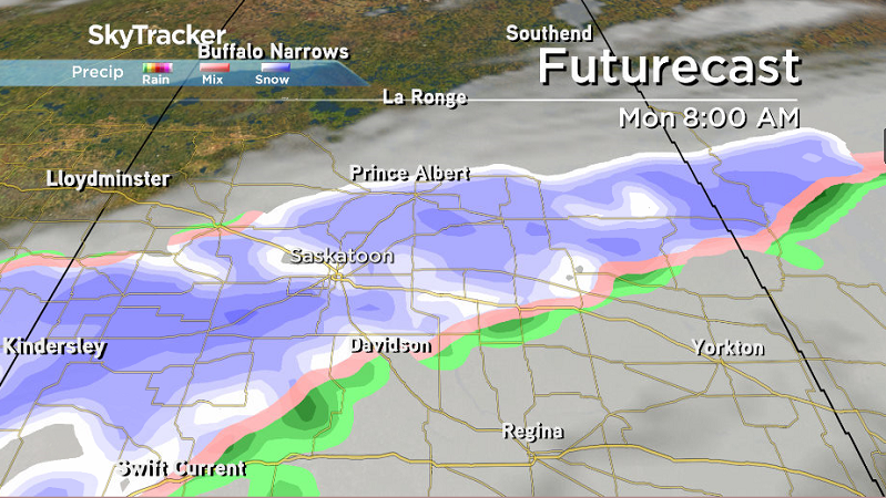
There is not model consistency with this snow, it may end up only affecting areas south and east of Saskatoon, but regardless, the risk is there.
Daytime highs will attempt to make it into double digits on Monday before climbing back into the mid-teens mid-week and possibly reaching the 20s by Friday with clouds in and out right into the first few days of May.

Lori Van Woert took the April 27 Your Saskatchewan photo in Regina:

Saskatoon weather outlook is your source for Saskatoon’s most accurate forecast and is your one stop shop for all things weather for central and northern Saskatchewan with comprehensive, in depth analysis that you can only find here.
Comments
Want to discuss? Please read our Commenting Policy first.