March roars in like a lion with a snowstorm expected.

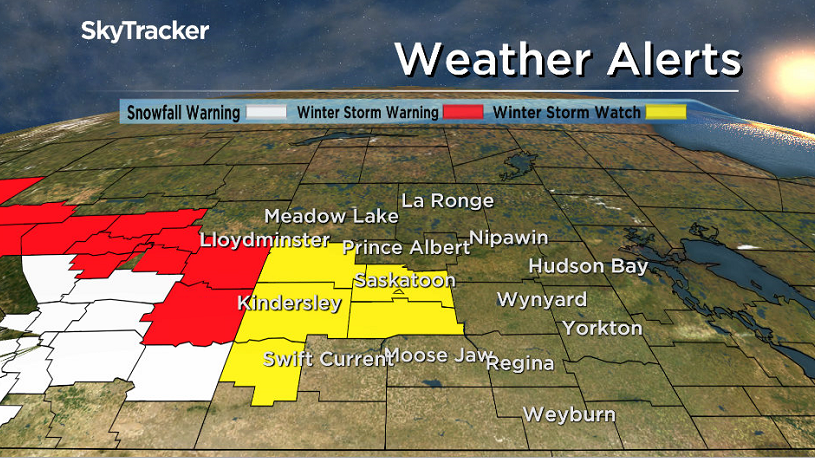
Winter Storm Watch
Environment Canada has issued a winter storm watch for Saskatoon and parts of central Saskatchewan for snow and blowing snow developing Friday night.
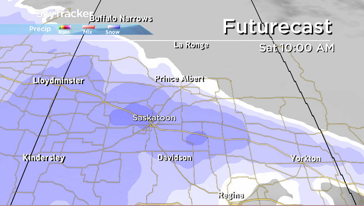
A developing winter storm is forecast to move through Alberta on Friday and spread into western Saskatchewan by Saturday morning.
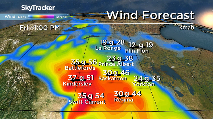
Strong winds of 40 to 50 km/h will combine with the falling snow to produce significant visibility restrictions in blowing snow.
Total snowfall of 10 to 20 centimetres is possible with this storm.
The strong winds and heaviest snow are forecast to taper off by Saturday evening with lght snow persisting into Sunday.
Rapidly accumulating snow could make travel hazardous over some locations due to reduced visibility and may contribute to transportation delays.
Motorists planning to head out on roads are advised to use caution and check in with Saskatchewan Highway Hotline before heading out.
For the latest weather alerts download the Global News SkyTracker Weather App for iPhone, iPad or Android.
Saskatoon Forecast
Wednesday
A fabulous finish to February with beautiful blue skies and sunshine to start the day with conditions a little on the cool side this morning, down to -17 with wind chills as cold as -25.
We managed to make it all the way up into mid-minus single digits before noon as sunny skies continued into the afternoon.
The final day of the month finished on a mild note with the sun helping warm us up to the freezing mark for a daytime high.

Get breaking National news
Thursday
-25 is around what it’ll feel like as you head out on the first morning of March with some sunny breaks possible to start before clouds roll back in before noon.
Cloudy skies will stick around for the rest of the day with a breezy wind kicking in later on as we warm up to an afternoon high in mid-minus single digits.
Friday
A system on the coast will spawn a new low pressure system on our side of the Rockies that will keep us in the clouds to finish off the week with snow moving in by evening.
Winds will also pick up during the day, up to 30 km/h with gusts in excess of 50 to 60 km/h possible as we warm up to an afternoon high close to the freezing mark.
Weekend Outlook
That low pressure system will swing through this weekend, bringing heavy snow on Saturday with 10 to 15 centimetres possible by the evening along with winds gusting up to 50 km/h reducing visibility, making travel treacherous.
We’ll sit in mid-minus single digits on Saturday before cooling back a bit further on Sunday under cloudy skies with a chance of lingering snow.
We are still a few days away, so you’ll want to be sure to check back in as the weekend approaches and we continue to refine the forecast for this expected snowstorm.
The Feb. 28 Your Saskatchewan photo of Molly the moose was taken by Blanche Allingham in Young:
Saskatoon weather outlook is your source for Saskatoon’s most accurate forecast and is your one stop shop for all things weather for central and northern Saskatchewan with comprehensive, in depth analysis that you can only find here.


Comments
Want to discuss? Please read our Commenting Policy first.