

Behind a blast of wind and blowing snow is an arctic invasion.

Saskatoon Forecast
Tuesday
It was a blustery start to our Tuesday with winds gusting up to 66 km/h in the morning blowing the fresh snow that fell on Friday around, which reduced visibility below two kilometres at times in the city.
READ MORE: Slippery driving conditions in Saskatoon
Wind warnings were ended for Saskatoon mid-morning with snowfall warnings for 10 to 25 centimetres of snow possible in parts of northern Saskatchewan, including Prince Albert and La Ronge.
Trecherous travel conditions were reported across the region with Saskatchewan RCMP advising motorists not to travel unless absolutely necessary.
It was a warm morning with temperatures climbing up to -1 degrees, but fiercely strong winds at sustained speeds up to 50 km/h kept it feeling like minus double digits with wind chill.
We quickly cooled back into minus double digits behind a cold front before noon with light snow that started this morning continuing to fall and blow around with winds gusting upwards of 60 km/h at times.

Get daily National news
We’ll continuef to cool toward the minus teens through the remainder of the day as wind chills dropped back into the -20s.
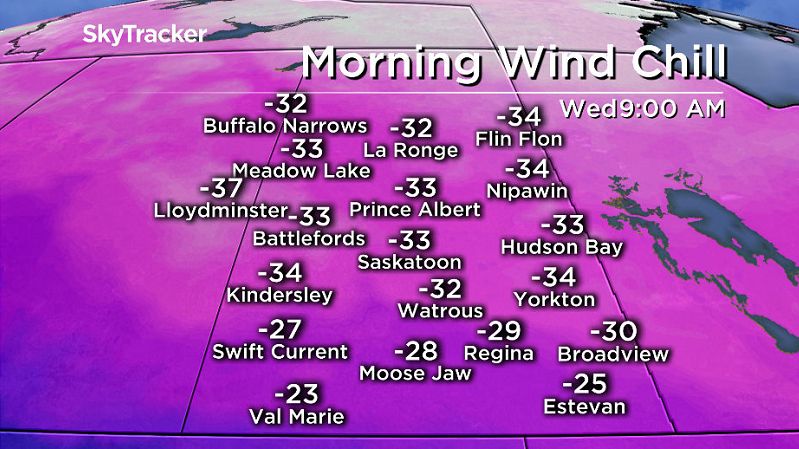
Wednesday
Arctic air will drop back in behind Tuesday’s low pressure system, which will keep us under a cool northwesterly wind during the day.
It’ll feel like the -30s with wind chill as you’re heading out in the morning with mostly to partly cloudy skies expected during the day with temperatures struggling to get up into the minus teens during the afternoon.


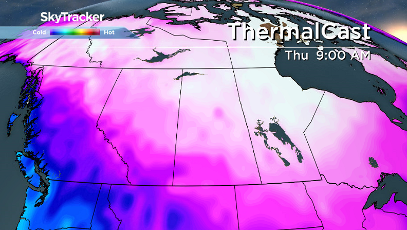
Thursday-Friday
We’ll drop even further to round off the work week with daytime highs diving back into the -20s and overnight lows pushing toward the -30s.
Clouds are expected to linger at times for the rest of the week with a slight chance of flurries on Thursday and a better risk into Friday.

Weekend Outlook
Clouds then clear out this weekend, bringing us back into blue skies and sunshine, but it’ll allow us to fall even further with overnight lows into the -30s and extreme cold -40 morning wind chills possible as we struggle to get up toward -20 for afternoon highs both days.

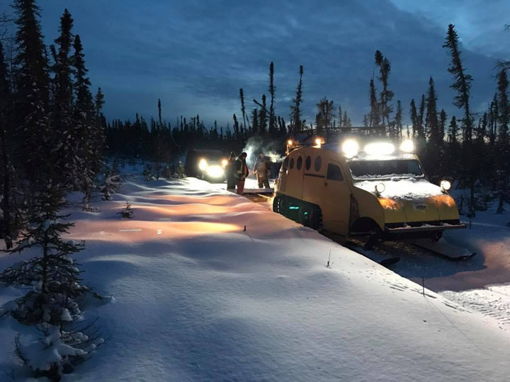
Charles Alcrow took the Your Saskatchewan photo for Jan. 30 near Dore Lake:
Saskatoon weather outlook is your source for Saskatoon’s most accurate forecast and is your one stop shop for all things weather for central and northern Saskatchewan with comprehensive, in depth analysis that you can only find here.
Comments
Want to discuss? Please read our Commenting Policy first.