

Record breaking daytime highs at stake over the next few days.

Saskatoon Forecast
Wednesday
Despite mostly clear skies overnight, it was a mild morning, thanks to a breezy southwesterly wind that kicked in and kept temperatures around -8 by daybreak.
Wind chills remained in the minus teens to start the day as clouds rolled in and we warmed up to +4 before noon with some rain as breezy westerly winds kicked in with gusts up to 50 km/h continuing into the afternoon, helping to mix down some very warm air.
Those clouds cleared back out during the afternoon as the disturbance responsible for bringing them in slides east and we finished the day with some sunshine as we climbed up above freezing for the second time this year.

Get breaking National news
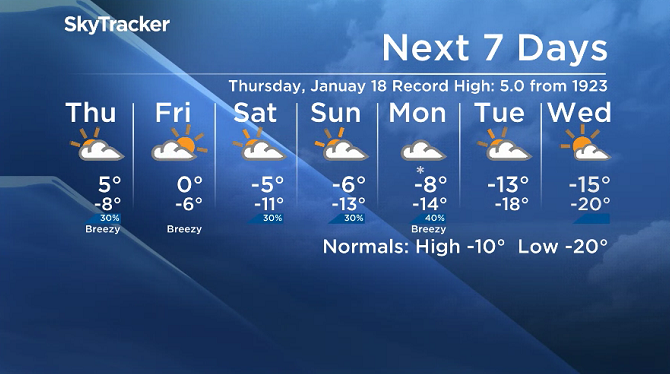
Saskatoon’s high temperature record for Jan. 17 is 5.0 degrees set in 1923, which was broken at 3 p.m. when the mercury rose up to 5.4 degrees in the city.
Thursday
It’ll feel like the mid-minus teens with wind chill to start the day on Thursday with mostly cloudy skies expected to dominate the majority of the day.
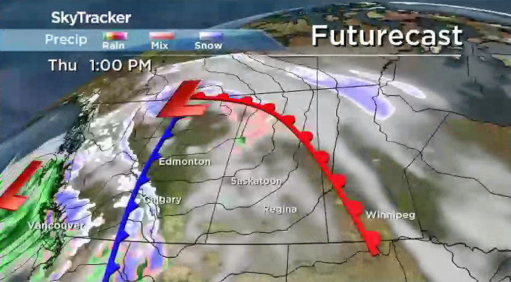
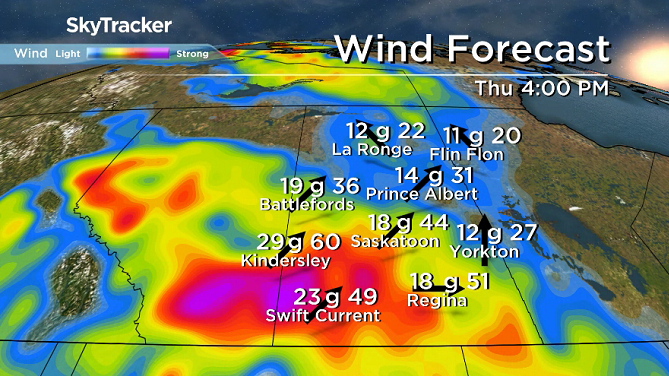
Breezy southwesterly winds will continue through the day as we sit in the warm sector of a system swinging through, which will help warm us up five degrees or so above freezing by afternoon.


Our record high for this date is 5.0 degrees from 1923, which will likely be out of reach, but it is possible that a brief wind gust could mix down air that’s in the 5 to 7 degree range that’s just above the ground.
Friday
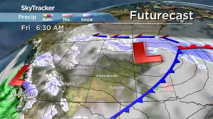
Slightly cooler air will sink in behind that system as it slides by on Friday, dropping our daytime high back below freezing, but barely.
There is a chance of a few sunny breaks in the morning, but clouds are expected to roll back in with a slight chance of flurries later in the day.
Weekend Outlook
A weak system swinging through on Saturday should keep us in the clouds with a slight chance of snow, a forecast that’ll hold into Sunday as a cold front approaches and drops temperatures back into minus double digits before a snow-carrying system may move in on Monday.
Mark Duffy took the Jan. 17 Your Saskatchewan photo in Moose Jaw:

READ MORE: Get a 2018 Your Saskatchewan Calendar today
Saskatoon weather outlook is your source for Saskatoon’s most accurate forecast and is your one stop shop for all things weather for central and northern Saskatchewan with comprehensive, in depth analysis that you can only find here.
Comments
Want to discuss? Please read our Commenting Policy first.