
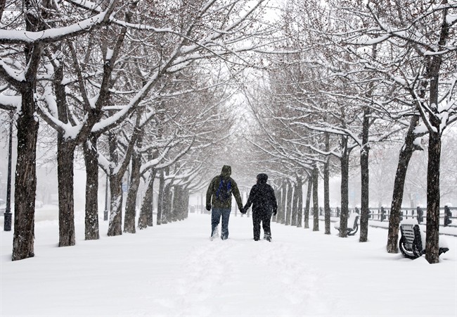
It doesn’t look like Jack Frost will be letting up any time soon in Guelph and Waterloo region as frigid conditions are expected to last through the week.

Environment Canada has issued an Extreme Cold Warning for southwestern Ontario, including the Royal City, as the wind chill will make it feel close to -30 Tuesday night.
For the rest of the week, the weather office is forecasting highs ranging from -11 C to -17 C before wind chill.

Get breaking National news
READ MORE: Niagara Falls’ breathtaking winter views are the upside of this extreme cold
“This Arctic air mass is not just affecting southern Ontario. In fact, much of Canada is seeing temperatures some 10 to 20 degrees below average,” said Global News meteorologist Anthony Farnell.
He does say we can still expect a “January thaw” to happen later this month.


READ MORE: Polar bear dips: Canada’s bravest ring in the new year with an icy swim
Environment Canada has also identified record-breaking temperatures in four Canadian provinces on New Year’s Eve and New Year’s Day.
Alberta and Saskatchewan saw an all-time low on Dec. 31, while Ontario and Quebec broke their respective records for lowest temperature on New Year’s Day.
The coldest new record low-temperature was in La Grande Rivière, Que., where the mercury dropped to -48.2 C early Monday.
– With files from Jaclyn Carbone
- ‘Alarming trend’ of more international students claiming asylum: minister
- Justin Trudeau headed to UN Summit of the Future amid international instability
- Canadian government’s satellite deal has Tories calling for Elon Musk involvement
- Activists call for Boogie the monkey to be removed from Ontario roadside zoo


Comments