Snow falling reduces visibility and deteriorates road conditions in central Saskatchewan with another warm-up on the horizon.

Saskatoon Forecast
Tuesday
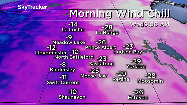
-30 is what it felt like with wind chill Monday night as temperatures fell back into the -20s overnight before warming up into the minus teens with wind chills in the -20s to start the day.
Light snow started the day, enough to make for a slippery morning commute with visibility dropping to a few kilometres by noon as we warmed up into minus single digits.
Winds picked up during the afternoon with gusts upwards of 40 to 50 km/h as light snow continued reducing visibility and deteriorating road conditions at times as we rose up to a daytime high around the freezing mark.

Get daily National news
Wednesday
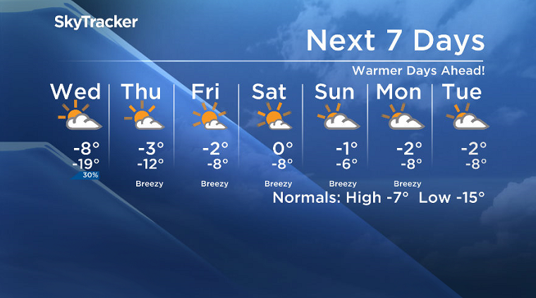
-28 is around what it’ll feel like with wind chill Wednesday morning with partly to mostly cloudy skies and a slight chance of flurries for the first half of the day before we get into a few sunny breaks later on.
We’ll struggle to make it into minus single digits for a daytime high, but should be able to by a few degrees, but it’ll be feeling like the minus teens all day with wind chill.
Thursday-Friday
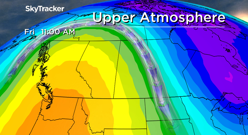
A building upper ridge of high pressure will help boost us up into some warmer air to finish the week under a mix of sun and cloud on Thursday with even more sunshine on Friday.
Daytime highs should spring up to just a few degrees shy of the freezing mark both days with Friday being a degree or so warmer than Thursday.
Weekend Outlook
The warm air sticks around along with the upper ridge for the weekend with daytime highs potentially even popping up above freezing under mostly sunny skies on Saturday before clouds roll back in Sunday.
Jeff Wizniak took this shot of the CP Holiday Train arriving in Saskatoon for the Dec. 5 Your Saskatchewan photo:
Saskatoon weather outlook is your source for Saskatoon’s most accurate forecast and is your one stop shop for all things weather for central and northern Saskatchewan with comprehensive, in depth analysis that you can only find here.
- Much of Canada faces extreme cold, heavy snow in latest winter blast
- 3 in 10 Albertans would vote for independence — but only half committed to separating: poll
- Pimicikamak Cree Nation to evacuate 79 more homes after military assessment
- China’s envoy says Beijing, Ottawa ‘eye to eye’ on supporting Greenland


Comments