

-30 wind chills move in, followed by snow to start our Tuesday.

Fall 2017
Meteorological fall contains the months of September, October and November, and in Saskatoon, it was slightly drier and colder than normal.
Temperatures trended around 0.37 degrees colder than normal throughout the month, thanks to a well below normal November that followed a warmer than normal September and October.

Most of that was on the overnight low end of the scale, which trended nearly one degree colder than normal, which is very significant when averaging out over 90 days of data.
Daytime highs actually averaged out a tenth of a degree warmer than normal.

Precipitation-wise, we had 61 millimetres of rain and melted snow reported at the airport, when normally the three month period reports 67.2 millimetres.
Saskatoon Forecast
Monday
-23 is what it felt like with wind chill Monday morning in Saskatoon as temperatures fell back to -16 degrees.
Light snow started the day and continued through the morning as we warmed up toward, but not quite into minus single digits by noon.
Snow eased during the afternoon with clouds clearing later on as we rose up to an afternoon high just into minus single digits before falling back to -30 wind chills with temperatures in the -20s overnight.

Get daily National news
Tuesday
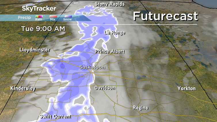
-26 is around what it’ll feel like with wind chill as you head out Tuesday morning with snow to start the day.
That snow will continue until midday before tapering off with just a few centimetres expected to fall, but a chance of flurries moves back in during the afternoon and evening as we rise up to an afternoon high in mid-minus single digits.


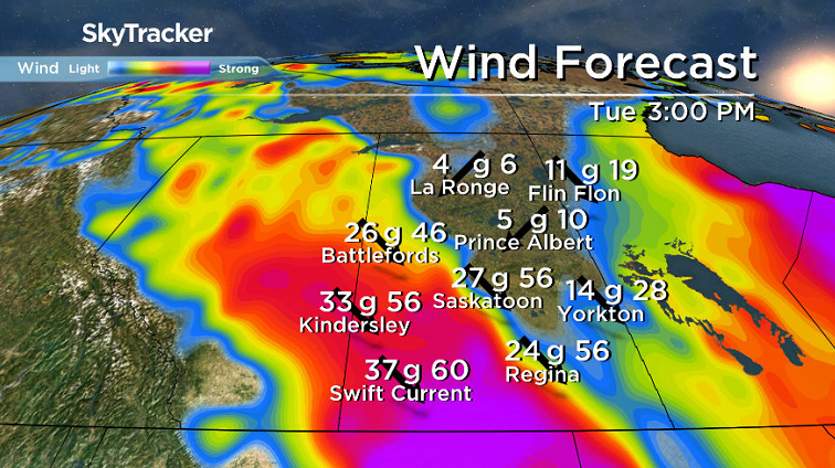
It’ll feel like the minus teens with wind chill all day Tuesday with cool northwesterly winds kicking in during the afternoon up to 30 km/h, potentially gusting in excess of 50 km/h at times.
Wednesday-Friday
There’s a slight chance of flurries early Wednesday before we get into some sunny breaks later on as we break into a mix of sun and cloud for the remainder of the week.
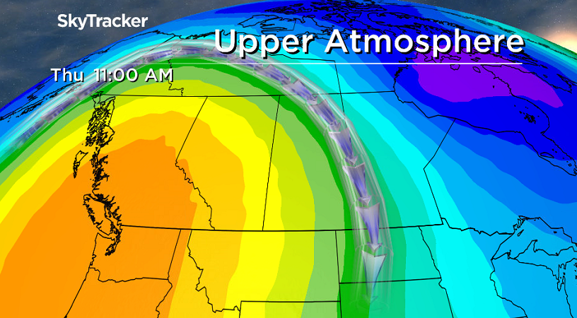
After a slightly cooler Wednesday with a daytime high in mid-minus single digits, warmer temperatures will move back in for the rest of the week with daytime highs just a few degrees shy of the freezing mark as an upper ridge builds in.
Weekend Outlook
It’ll be a mild weekend as well with daytime highs pushing up toward and possible even above the freezing mark on Saturday under mostly sunny skies before more clouds move in Sunday with an afternoon high just below freezing.

The Your Saskatchewan photo for Dec. 4 was taken near Humboldt by Brenda Reifferscheid:

MORE: Get a 2017 Your Saskatchewan calendar today
Saskatoon weather outlook is your source for Saskatoon’s most accurate forecast and is your one stop shop for all things weather for central and northern Saskatchewan with comprehensive, in depth analysis that you can only find here.
- ‘Alarming trend’ of more international students claiming asylum: minister
- TD Bank moves to seize home of Russian-Canadian jailed for smuggling tech to Kremlin
- Why B.C. election could serve as a ‘trial run’ for next federal campaign
- Justin Trudeau headed to UN Summit of the Future amid international instability


Comments