
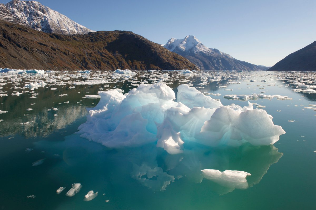
A new tool developed by NASA scientists can pinpoint which glaciers and ice sheets are contributing to changing sea levels in almost 300 coastal cities.

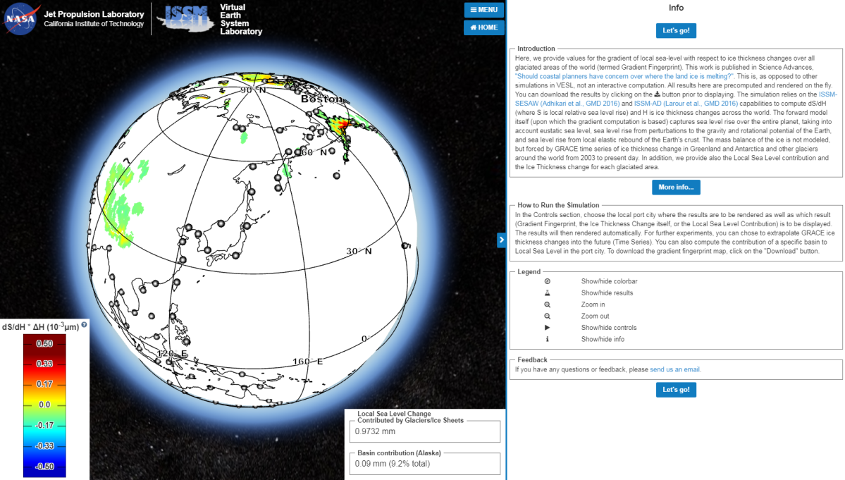
The Gradient Fingerprint Mapping Simulation allows users to spin a virtual globe and select one of hundreds of coastal cities, which will then produce a small blurb about how much sea levels are projected to rise in the area and the name of the contributing glacier.
The accompanying study analyzes 293 major port cities and aims to let coastal planners accurately calculate local sea level changes as well as know which melting parts of the Earth’s polar ice cap present the biggest risks to each region.

-
![]() Indonesia scrambles to save disappearing coastline
Indonesia scrambles to save disappearing coastline -
![]() NASA launches weather satellite to help forecast droughts, forest fires
NASA launches weather satellite to help forecast droughts, forest fires -
![]() NASA’s playlist of spooky sounds from space
NASA’s playlist of spooky sounds from space -
![]() NASA conducts second spacewalk to repair the iconic Canadarm
NASA conducts second spacewalk to repair the iconic Canadarm -
![]() Flu shots available in Alberta starting Oct. 23; AHS not offering nasal spray
Flu shots available in Alberta starting Oct. 23; AHS not offering nasal spray -
![]() NASA conducts spacewalk to repair the Canadaarm
NASA conducts spacewalk to repair the Canadaarm -
![]() After eight months, NASA space isolation experiment comes to an end
After eight months, NASA space isolation experiment comes to an end -
![]() NASA’s Cassini Saturn mission ends
NASA’s Cassini Saturn mission ends -
![]() Farewell, Cassini: Saturn probe sends final transmission to NASA
Farewell, Cassini: Saturn probe sends final transmission to NASA -
![]() NASA concludes Cassini mission to Saturn
NASA concludes Cassini mission to Saturn -
![]() NASA’s Saturn-orbiting Cassini spacecraft faces fiery finish
NASA’s Saturn-orbiting Cassini spacecraft faces fiery finish -
![]() NASA releases retrospective video as Cassini mission over Saturn comes to an end
NASA releases retrospective video as Cassini mission over Saturn comes to an end -
![]() NASA observatory records most powerful solar flare in over a decade
NASA observatory records most powerful solar flare in over a decade -
![]() NASA astronaut Peggy Whitson returns to Earth after an astonishing 665 days in space
NASA astronaut Peggy Whitson returns to Earth after an astonishing 665 days in space -
![]() George Takei narrates new NASA video about what causes a total solar eclipse
George Takei narrates new NASA video about what causes a total solar eclipse


Early in November, the U.S. government released a major climate change report which revealed sea levels have risen by between seven and eight inches since 1900, with the last 25 years making up almost half that increase. While sea levels were projected to rise by between one and four feet around the world by 2100, the report acknowledged that the changes will be different for everyone.
For example, the tool shows that the impact of Greenland melting will pose challenges for major metropolises like New York and London. The study reveals that as quadrants of Greenland continue to melt, both New York and London are vulnerable to rising sea levels.
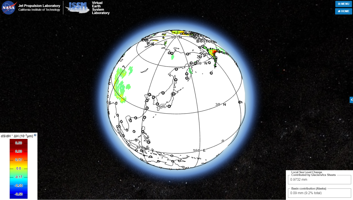
While New York residents will primarily receive contributions from the northwest and northeast quadrants of Greenland, London residents should be more concerned about the northwest portion of the island.

Get daily National news
The study found that because of gravity, the biggest contributions to local sea level rise would come from glaciers and ice sheets farthest away from the cities.

-
![]() NASA plans to test interplanetary ‘mega-rocket’ soon
NASA plans to test interplanetary ‘mega-rocket’ soon -
![]() NASA seeks applicants for Planetary Protection Officers job
NASA seeks applicants for Planetary Protection Officers job -
![]() NASA hiring someone to protect Earth from aliens
NASA hiring someone to protect Earth from aliens -
![]() NASA releases flyover video of Pluto
NASA releases flyover video of Pluto -
![]() NASA images provide new look at iceberg which broke off Larsen C ice shelf
NASA images provide new look at iceberg which broke off Larsen C ice shelf -
![]() NASA renames probe set to test the sun’s heat
NASA renames probe set to test the sun’s heat -
![]() NASA space cameras capture mysterious flashes of light from Earth
NASA space cameras capture mysterious flashes of light from Earth -
![]() NASA’s Cassini captures the sounds of Saturn’s rings
NASA’s Cassini captures the sounds of Saturn’s rings -
![]() NASA’s Cassini flies inside Saturn’s rings and sends back images
NASA’s Cassini flies inside Saturn’s rings and sends back images -
![]() NASA: One of Saturn’s moons supports life
NASA: One of Saturn’s moons supports life -
![]() NASA says Saturn’s moon has oceans that could support life
NASA says Saturn’s moon has oceans that could support life -
![]() Donald Trump signs bill authorizing NASA funding to explore Mars
Donald Trump signs bill authorizing NASA funding to explore Mars -
![]() White House comments on executive order committing NASA to planetary landing
White House comments on executive order committing NASA to planetary landing -
![]() Help name NASA’s planets #7NamesFor7Planets
Help name NASA’s planets #7NamesFor7Planets


For this reason, cities like Halifax and Reykjavik, Iceland, may actually see sea levels decrease.
Knowing more about how much the ocean will rise by specific dates will be extremely useful to city planners laying out strategies to mitigate this issue.


Comments