

UPDATE: All wind warnings mentioned in this story have ended

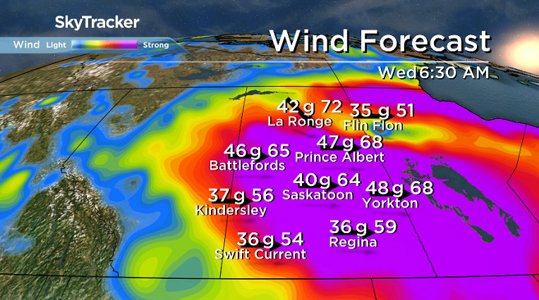
A major wind storm brings damaging wind gusts upwards of 100 to 110 km/h in Saskatoon.
Wind Warning Ended
Environment Canada has issued a wind warning for Saskatoon and all of central and southern Saskatchewan for strong winds that may cause damage.
A very intense low pressure system will move through central Saskatchewan Tuesday night and begin to spread very strong wind gusts of 90 to 100 km/h into the region beginning late Tuesday afternoon.
READ MORE: Saskatoon preparing for possible damaging winds
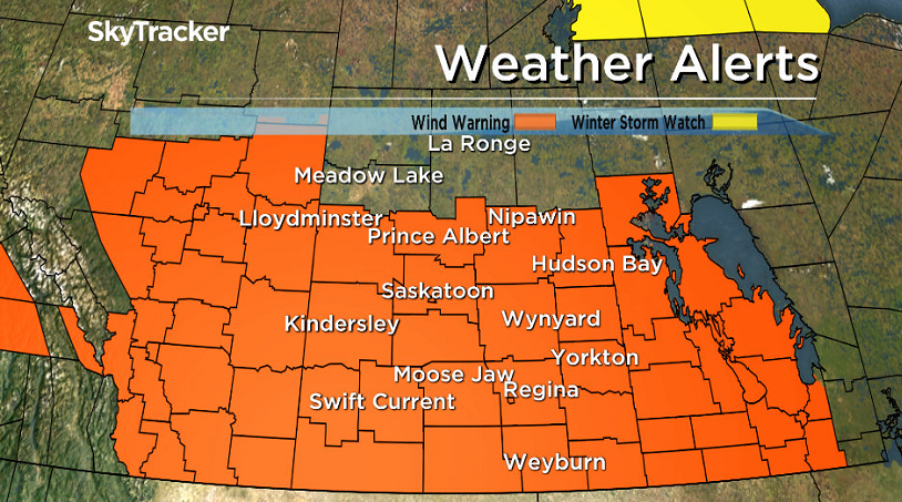
Wind prone areas in the lee of the Cypress Hills may see gusts of 110 km/h.
The strong winds will abate Tuesday night or early Wednesday as the system tracks into Manitoba.
READ MORE: Evacuations ordered in southwest Sask. as wildfire threatens communities
Damage to buildings, such as to roof shingles and windows, is possible and the wind may toss loose objects or cause tree branches to break.


Get breaking National news
For the latest weather alerts download the Global News Skytracker weather app for iPhone, iPad or Android.
Saskatoon Forecast
Tuesday
3 degrees was where Saskatoon started the day under mostly clear skies and light winds.
A warm south-southwesterly wind picked up by noon, helping boost temperatures up into the mid teens as clouds built back in.
Temperatures soared up into the mid 20s for an afternoon high as the breezy southwesterly wind continued to strengthen and mostly cloudy skies stuck around.
Tuesday Night
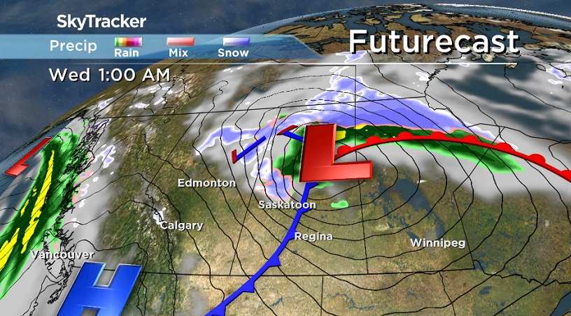
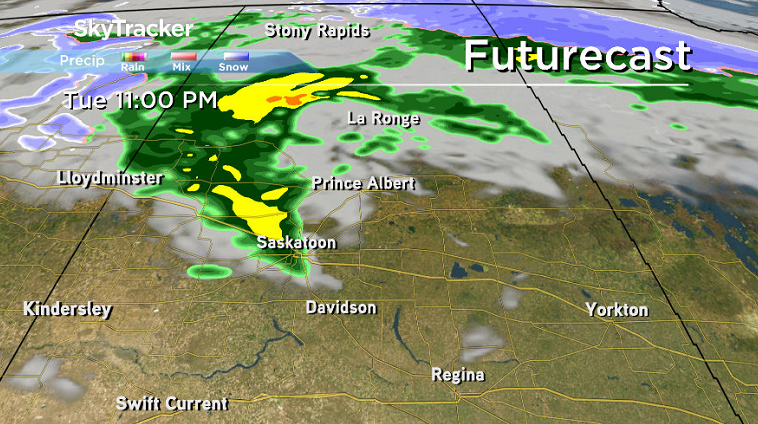
A cold front swept through Tuesday night, bringing in rain and cooling us back into mid single digits, but the big story was the extremely strong winds moved in.
Instability along the front will allow strong winds above the ground to mix down with speeds expected up to 70 km/h in Saskatoon and gusts reaching 100 km/h or higher, which may cause significant damage and power outages in areas.
Be sure to secure or bring in any loose items that may be outdoors before winds start to pick up in the early evening hours.
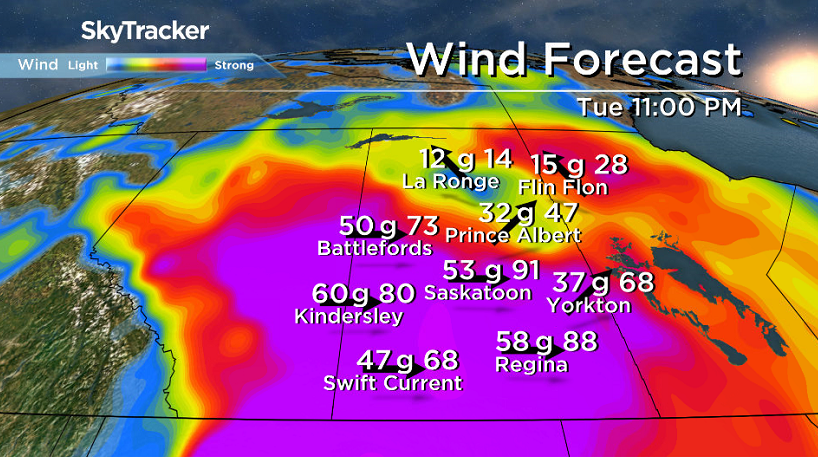
The strongest winds are expected to hit the city between 10 p.m. and 3 a.m., but will remain very brisk until midday Wednesday.
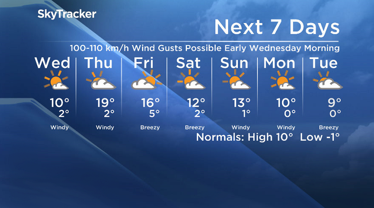
Wednesday
Winds will remain strong to start the day Wednesday with sustained speeds in excess of 50 km/h with gusts upwards of 70 or 80 km/h.
Mostly sunny skies will kick in as the system slides out, however cooler air will have settled in with a daytime high in double digits being a challenge to reach.
Thursday-Friday
A few more clouds will filter through on Thursday and Friday with winds remaining breezy at times.
Daytime highs will spring back up to the upper teens on Thursday and stay in the mid teens for Friday as an upper ridge builds back the heat to end the week.
Weekend Outlook
Cool air will slide back in on Saturday behind another cold front as another upper trough keeps skies partly to mostly cloudy for the weekend with daytime highs back into low double digits.
Brenda Reifferscheid took the Oct. 17 Your Saskatchewan photo near Humboldt:

Saskatoon weather outlook is your source for Saskatoon’s most accurate forecast and is your one stop shop for all things weather for central and northern Saskatchewan with comprehensive, in depth analysis that you can only find here.
Comments
Want to discuss? Please read our Commenting Policy first.