

Cold front crashes through, kicking up winds, a risk of precipitation and making it feel like minus double digits.

Snowfall Warning
Environment Canada has issued a snowfall warning for 10 to 20 centimetres of snow expected in the Key Lake and Collins Bay areas.
A low pressure centre developing in southern Alberta will move into Saskatchewan on Wednesday, bringing an area of heavy snow.
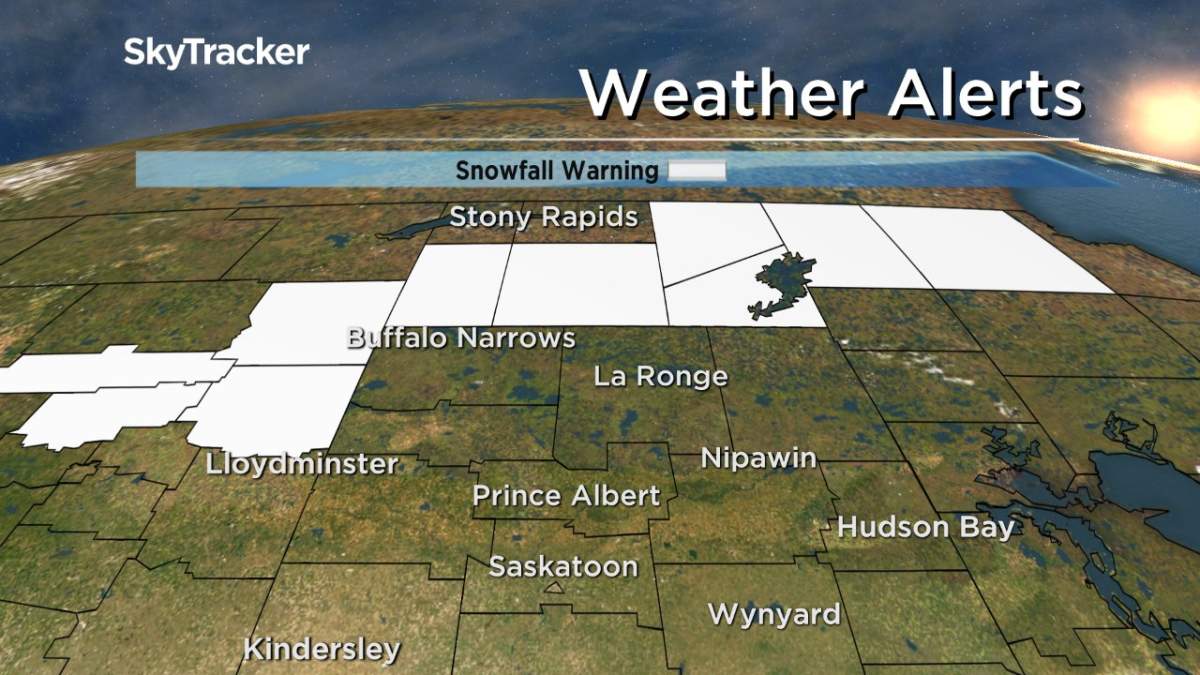
Snow will develop tomorrow morning with amounts of 10 to 20 centimetres forecast before it tapers off Thursday night.
Rapidly accumulating snow could make travel difficult in some locations.
For the latest weather alerts download the Global News Skytracker weather app for iPhone, iPad or Android.
Saskatoon Forecast
Wednesday
2 degrees was where Saskatoon started the day, under mostly cloudy skies as a system slides into the province.

Get daily National news
Double digits returned by noon as a breezy southwesterly wind kicked in and mostly cloudy skies continued.
We broke into a few more sunny breaks to end off the day as we climbed up to a daytime high in the mid teens.
Wednesday Night
Clouds returned in full force overnight as the cold front associated with a system swept through and brought in a chance of showers as we dipped back toward the freezing mark.
Thursday
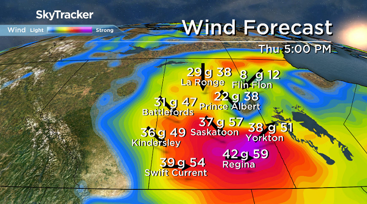
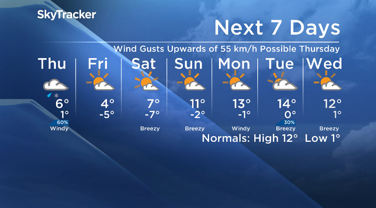
Cloudy skies will dominate the day with a chance of showers in the morning and a risk of a few flurries mixing in during the afternoon as we warm up to a daytime high in mid single digits.

It won’t be a washout of a day, but there is a chance of precipitation throughout as west-northwesterly winds kick up to 30 to 40 km/h with gusts upwards of 50 to 55 km/h at times.


Friday
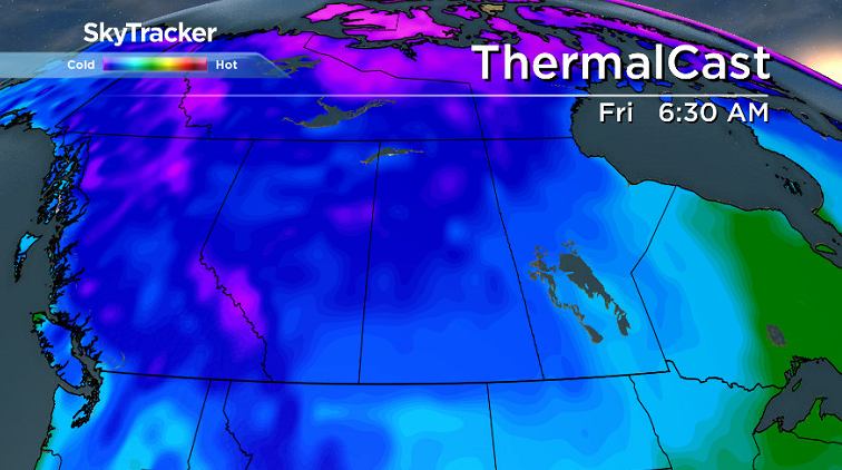
It’ll be a chilly start on Friday with temperatures dipping back into mid minus single digits and wind chill values falling into minus double digits in the morning.
Some more sunshine is expected during the day, which will help warm us up above freezing, to an afternoon high around 3 or 4 degrees.
Weekend Outlook
Cooler air will stick around to start the weekend with a chilly start again Saturday morning before recovering a bit further into single digits and a high just into double digits Sunday with a mix of sun and cloud both days.
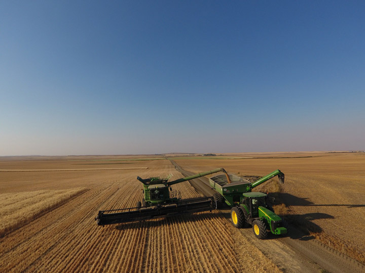
The Your Saskatchewan photo was taken near Beechy by Natalie Braun:
Saskatoon weather outlook is your source for Saskatoon’s most accurate forecast and is your one stop shop for all things weather for central and northern Saskatchewan with comprehensive, in depth analysis that you can only find here.
Comments
Want to discuss? Please read our Commenting Policy first.