

Cool start to autumn takes a turn for the first week of fall!

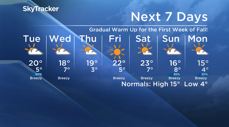
Saskatoon Forecast
Monday
After a cooler kickoff to autumn this weekend, the first full week of fall started out on a nicer note.
Sunshine started the day with temperatures dipping back to 2 degrees, but we managed to make our way up into the mid-teens by noon as a warm southerly wind kicked in.
Some high clouds built in from the west during the afternoon, but the mercury continued to rise, with a daytime high in the upper teens.

Get breaking National news
Tuesday
It’ll be a mostly cloudy start to the day Tuesday in the city with a chance of showers into the middle and end of the day as a trough swings through.
A southerly wind during the morning will help warm us up into the mid-teens quickly before a west-northwesterly winds kicks up in behind the trough with a high expected to reach just into the low 20s.

Wednesday-Friday
The heat gets cranked right up for the end of the week as a big upper ridge ploughs its way into the province with daytime highs jumping from the upper teens Wednesday and Thursday into the low 20s Friday.


More clouds than sunshine are expected on Wednesday before we get into more sun on Thursday and pure blue skies and sunshine to round off the week on Friday.

Weekend Outlook
The heart of the heat gets hit early this weekend as we climb up into the mid 20s under mostly sunny skies on Saturday before a system that may bring some rain and cloud cools us back into the teens for Sunday.
Fall/Winter Outlook
Seasonal forecasting is tricky, however there are early indications of cooler than normal waters off the coast of Peru, which would hint at a colder than normal trend moving in ahead, a big change after a sizzling summer in Saskatoon.
The National Weather Service in the United States has issued a La Niña watch, which means there is an increasing chance (~55 per cent to 60 per cent) of a La Niña to develop in the fall and winter.

What that would mean for central Saskatchewan if it does develop, is that cooler than normal temperatures would be expected on average for the end of fall and into winter.
That isn’t to say that we won’t see warmer than normal days, but when averaging out multiple months of data, this would just be the overall trend.
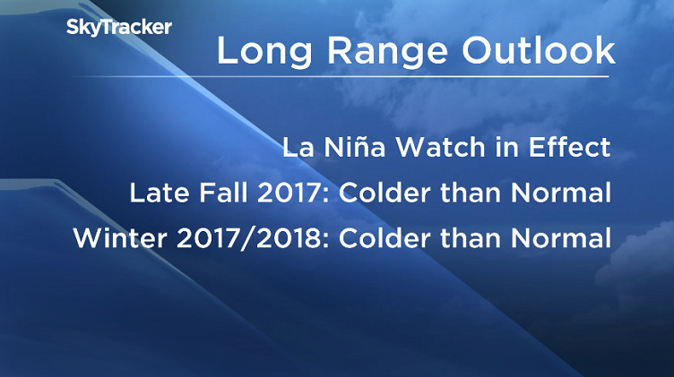
At this point there are no strong precipitation-trends apparent in either direction.
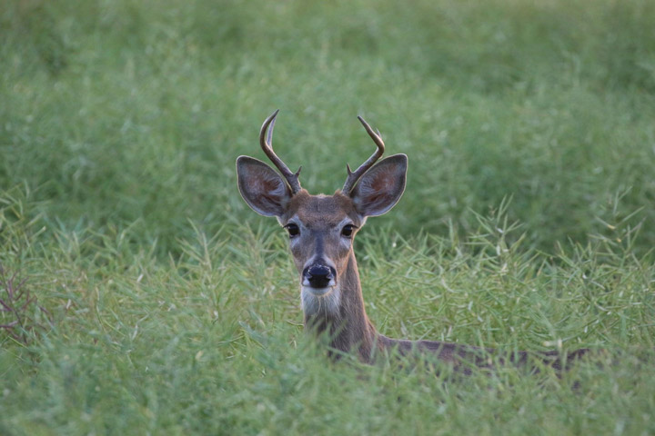
Jim Gawluk took this Your Saskatchewan photo in Fosston:
Saskatoon weather outlook is your source for Saskatoon’s most accurate forecast and is your one stop shop for all things weather for central and northern Saskatchewan with comprehensive, in depth analysis that you can only find here.
Comments
Want to discuss? Please read our Commenting Policy first.