Advertisement

Hurricane Harvey satellite photos show a devastating storm making landfall

Click to play video: 'Drone video shows devastation in Aransas Pass caused by Hurricane Harvey'
Drone video shows devastation in Aransas Pass caused by Hurricane Harvey
Hurricane Harvey flooded Aransas Pass, Texas, and left destruction in its wake, as seen in this August 27 drone footage released by the city’s police department – Aug 28, 2017

Hurricane Harvey has pounded Texas for four days, and the pictures on the ground are stunning.

Images from inside the storm show Texans fighting to escape the flooding, traversing the streets on powerboats and using trash bags for cover.

Coverage of Hurricane Harvey on Globalnews.ca:

Story continues below advertisement

And the scene from above also provides some memorable pictures.

NASA has released a number of views of the hurricane, using satellites, data and pictures taken directly from the International Space Station (ISS).

They show the Category 4 hurricane as it approaches Texas over the course of four days, bringing wind and rain so strong that it drowns people’s homes, forcing residents into shelters and even killing at least three people.

READ MORE: Harvey leaves Houston paralyzed with no relief in sight

The storm has brought over 30 inches of rain, with almost two more feet expected, in what a FEMA director called “probably the worst disaster the state’s seen.”

Here are some photos of what the storm looks like from above:

Rainfall

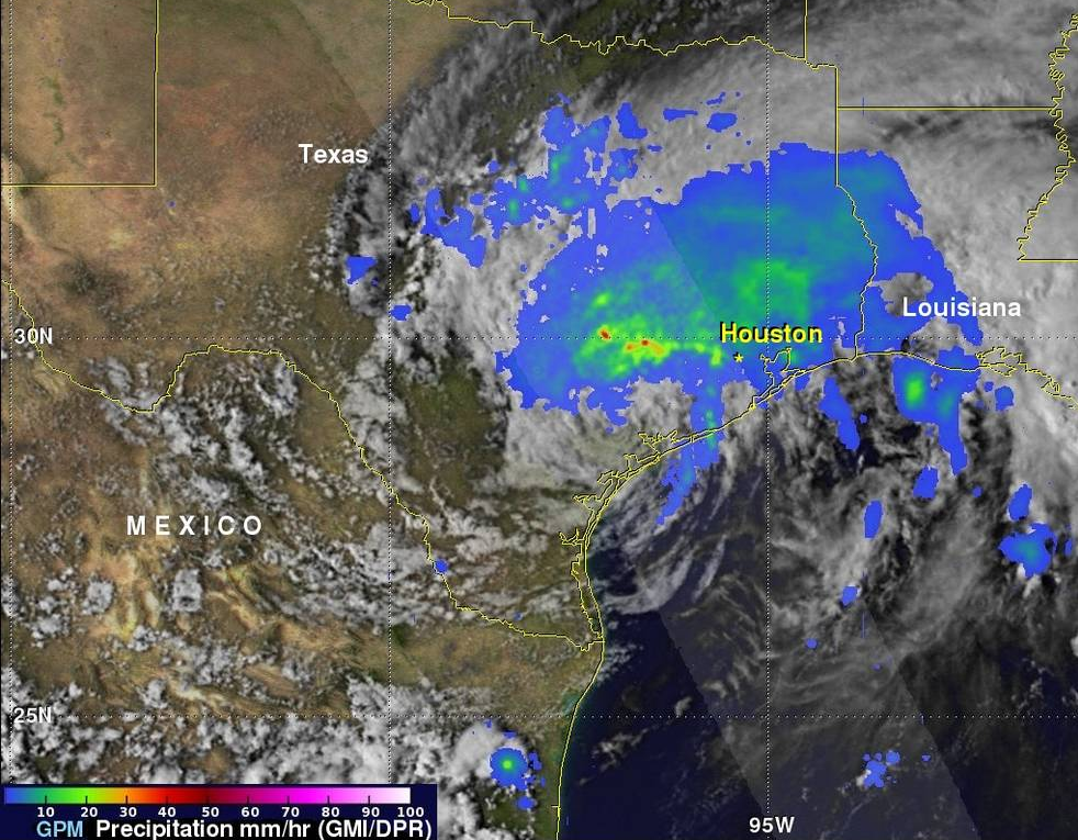
NASA’s Goddard Space Flight Center in Greenbelt, Md. analyzed Hurricane Harvey’s rainfall using satellite data from eight days.

The resulting visualization shows some of the strongest rains happening over the Houston area and nearby, falling at up to 50 millimetres per hour.

This visualization using data from NASA Earth shows the amount of rainfall that Hurricane Harvey has brought over Texas. NASA Earth

Harvey makes landfall

For news impacting Canada and around the world, sign up for breaking news alerts delivered directly to you when they happen.

Get breaking National news

For news impacting Canada and around the world, sign up for breaking news alerts delivered directly to you when they happen.
By providing your email address, you have read and agree to Global News' Terms and Conditions and Privacy Policy.

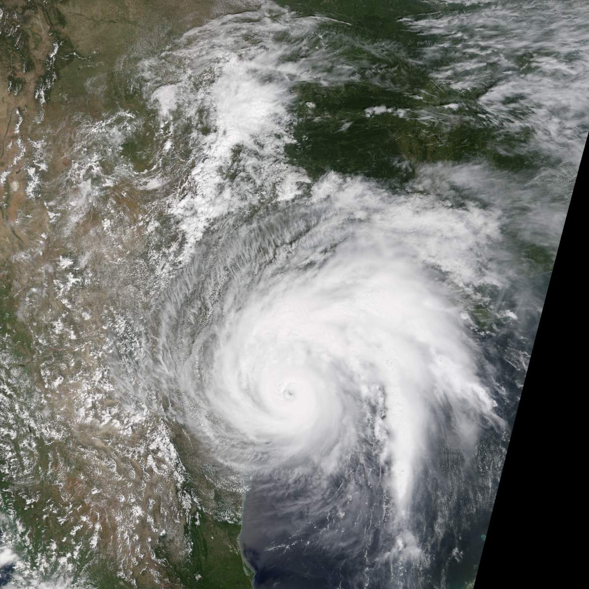
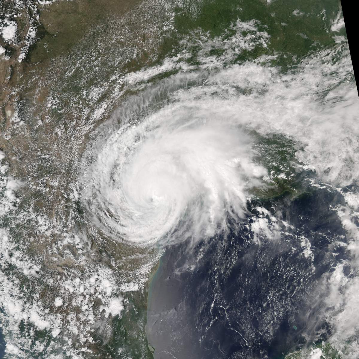
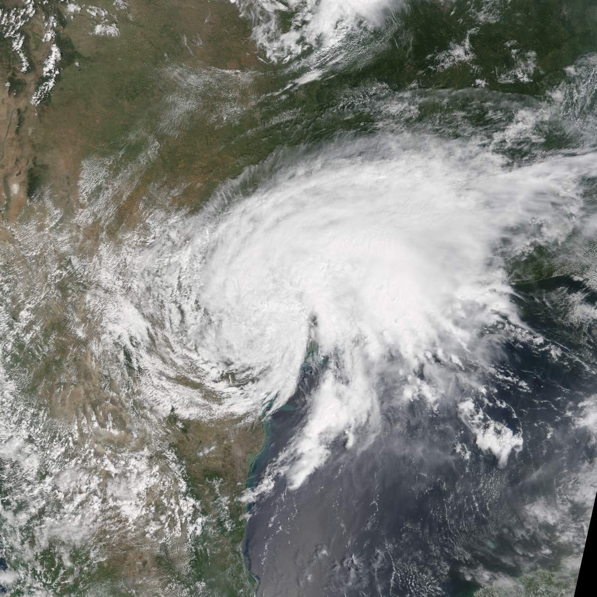
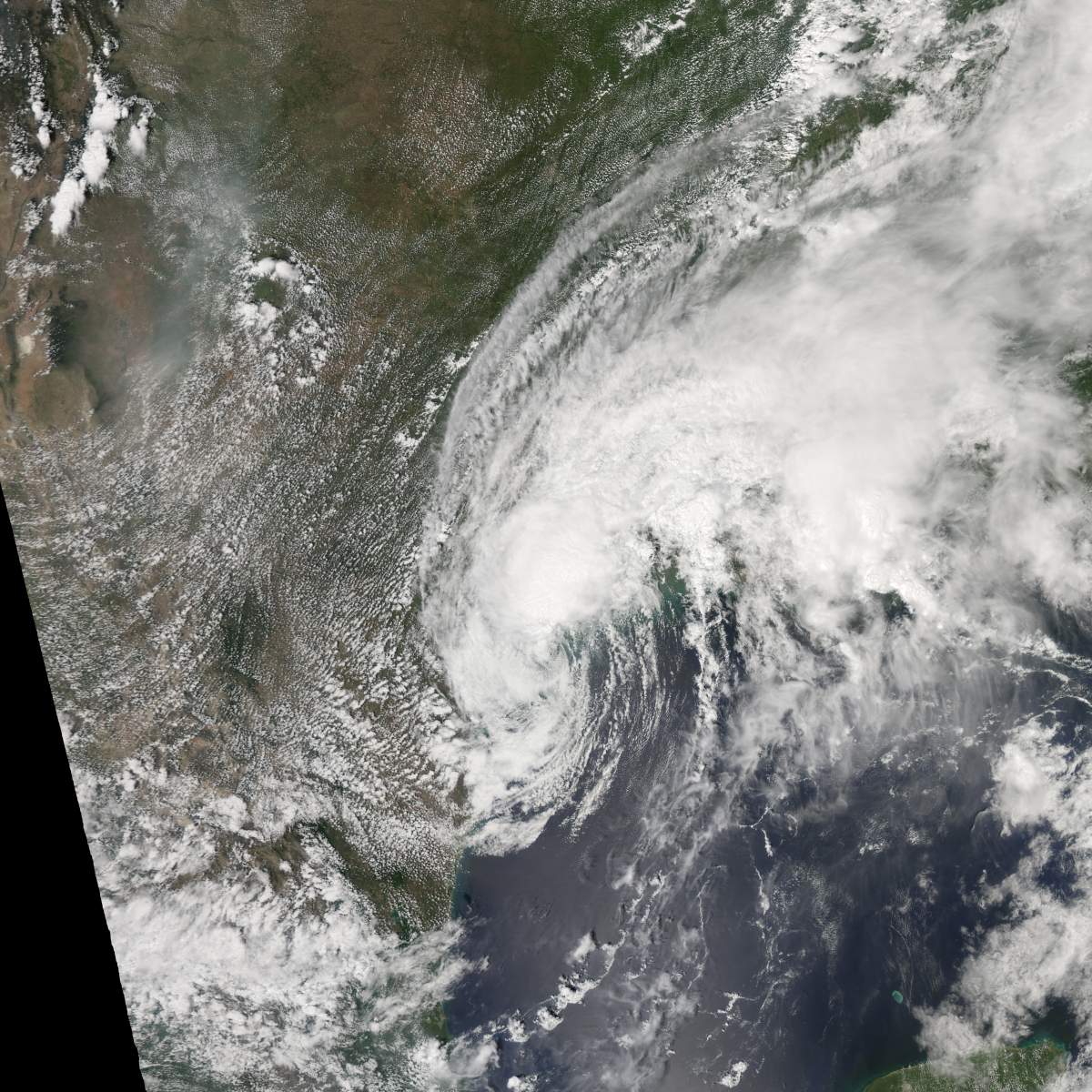
NASA Earth Observatory captured images of the storm slowly approaching the Texas coast  from Aug. 25 to 28.

Story continues below advertisement

The storm lost some steam on the last day, as it moved toward the coast at only seven kilometres per hour.

Aug. 25

This image shows the progression of Hurricane Harvey on Aug. 25, 2017. NASA Earth Observatory

Aug. 26

This image shows the progression of Hurricane Harvey on Aug. 26, 2017. NASA Earth Observatory

Aug. 27

This image shows the progression of Hurricane Harvey on Aug. 27, 2017. NASA Earth Observatory

Aug. 28

This image shows the progression of Hurricane Harvey on Aug. 28, 2017. NASA Earth Observatory

From the International Space Station

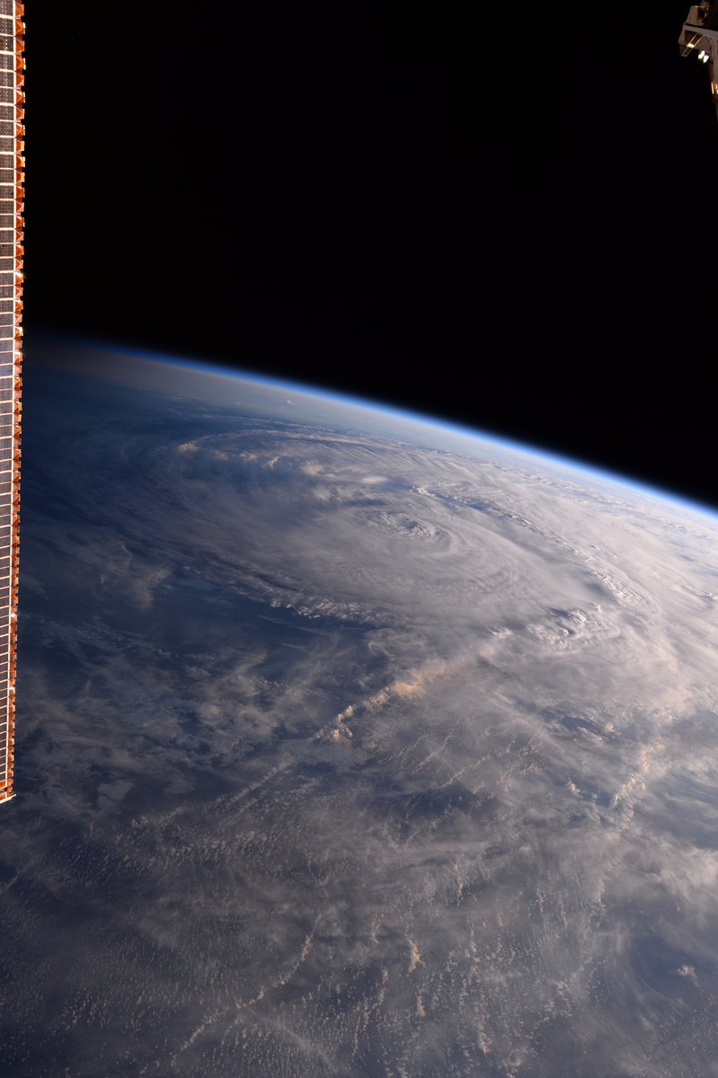
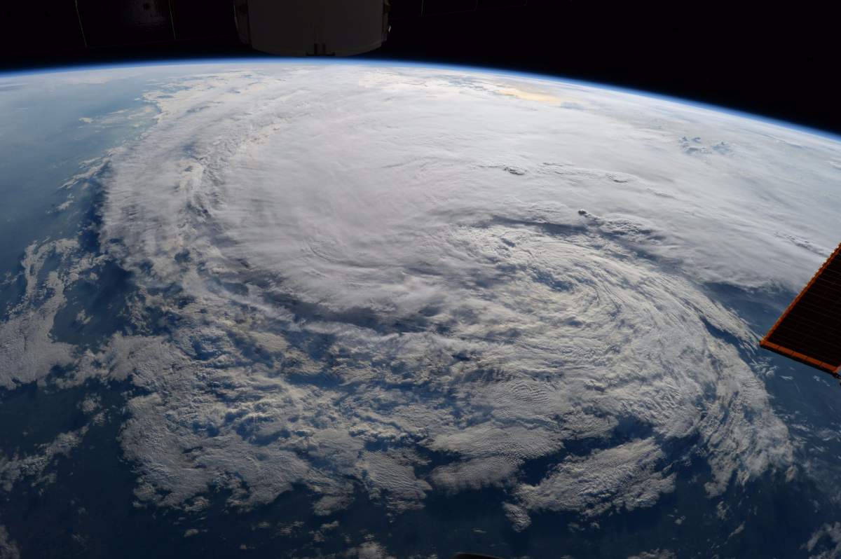
Images captured from the International Space Station provided a wider view of the hurricane as it approached Texas from Aug. 25 to 28.

Story continues below advertisement

Astronaut Randy Bresnik tweeted some of the photos saying, “God bless Texas, may you weather the storm as you always have!”

Hurricane Harvey is pictured off the coast of Texas, U.S. from aboard the International Space Station in this Aug. 25, 2017 NASA handout photo. NASA/Handout via REUTERS
Hurricane Harvey is pictured off the coast of Texas, U.S. from the cupola aboard the International Space Station in this August 25, 2017 NASA handout photo. NASA/Handout via REUTERS
This images shows the state of Hurricane Harvey from the International Space Station on Aug. 26, 2017. Randy Bresnik/Twitter
This photo taken from the International Space Station by astronaut Randy Bresnik was tweeted out on Aug. 28, 2017 with the caption, “still a menace!”. Randy Bresnik/Twitter

Sponsored content

AdChoices