

UPDATE: All watches and warnings mentioned in this story have ended

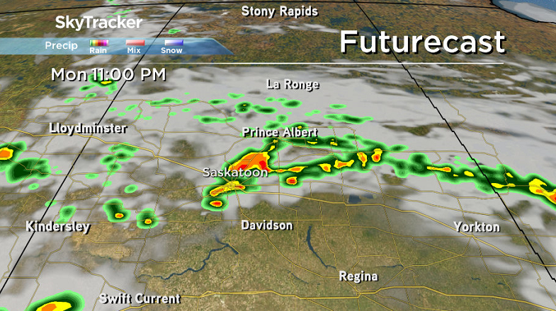
Environment Canada has issued a severe thunderstorm watch for Saskatoon, parts of central and southeast Saskatchewan including the city of Regina.
Conditions are favourable for the development of dangerous thunderstorms capable of producing damaging wind gusts, damaging hail and torrential rain.

READ MORE: Record-breaking heat in southern Saskatchewan
A low pressure system will track into south-central Saskatchewan bringing this risk to the area Monday afternoon and evening.
For the latest weather alerts download the Global News Skytracker weather app for iPhone, iPad or Android.
Saskatoon Forecast
Today
A thunderstorm with some light rain moved through overnight before clearing out a bit by morning as we cooled down to 17 degrees to start the day.
A mix of sun and clouds kicked off the morning as we warmed up to 26 degrees, which felt like 30 with humidity before noon!
A moderate easterly wind with gusts of 50 to 60 km/h will kick in ahead of a system bringing in a good chance of thunderstorms this afternoon as we warm up toward 30 degrees.

Get breaking National news
Tonight
There is a good chance of a severe thunderstorm this evening and overnight as a low pressure system swings over the area and the associated cold front moves through as we cool back to the mid-teens.
Winds will remain brisk from the northeast at sustained speeds up to 40 km/h with gusts upwards of 50 to 60 km/h at times as the front passes by.
Tuesday
Behind the system, a rain-making upper level low pressure system will develop over the region and bring in rain, heavier at times during the day.
Environment and Climate Change Canada says there is the chance of 3 to 6 centimetre hail, wind gusts over 110 km/h and the risk of a tornado with these storms.

15 to 30 millimetres may fall in some areas with models still showing some disagreement with exactly how much we’ll be hit with, however it will definitely be much needed moisture for the area.

A cool, northeasterly wind will continue to blow during the day up to sustained speeds of 30 to 40 km/h with gusts upwards of 50 to 60 km/h at times as we struggle to warm up to 17 degrees in the afternoon.
Wednesday-Friday
Clouds will linger with a slight chance of showers early Wednesday before sunshine returns as another upper ridge builds back in the heat we’ve become accustomed to for the rest of the week.
Daytime highs will make it back into the low 20s on Wednesday before pushing back into the low 30s Thursday and Friday.

Weekend Outlook
It looks like the upper ridge will hang on for the weekend ahead, keeping daytime highs in the low 30s with lots of sunshine and a few clouds with a slight risk of showers at times.

Linda Phillips took this Your Saskatchewan photo at Last Mountain Lake:

Saskatoon weather outlook is your source for Saskatoon’s most accurate forecast and is your one stop shop for all things weather for central and northern Saskatchewan with comprehensive, in depth analysis that you can only find here.


Comments
Want to discuss? Please read our Commenting Policy first.