
Thursday, May 11, 2017 – Weather forecast update at 4pm:

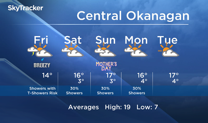
A cold front will move across the BC Southern Interior Thursday night and early Friday with showers and the risk of thundershowers under a flow from the south.

Get daily National news
Get the day's top news, political, economic, and current affairs headlines, delivered to your inbox once a day.
By providing your email address, you have read and agree to Global News' Terms and Conditions and Privacy Policy.
Breaks are possible on Friday in the wake of the cold front, but the unstable nature of the weather pattern will keep a risk of showers or thundershowers in the forecast.
The weekend will remain unsettled with sunny breaks and a slight risk of showers. Weekend daytime highs will be in the mid to upper teens.


Friday’s daytime high range: 11 to 18C
We will have the rest of your weather details coming up at 5 and 6:30 and 11pm – Hope you can join us!
~ Duane/Wesla


Comments