


Cool and snowy kickoff to March before we get onto a wild roller coaster of weather.

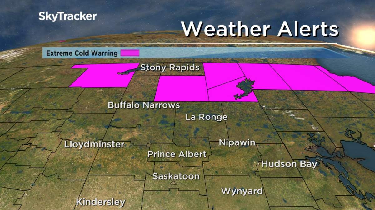
Extreme Cold Warning
Environment Canada has issued an extreme cold warning for the Key Lake, Southend and Collins Bay areas for a period of very cold wind chills.
Extreme cold is expected to persist until Friday in extreme northern Saskatchewan with wind chills near -45 during the morning hours over the next few days.
For the latest weather alerts download the Global News Skytracker weather app for iPhone, iPad or Android.
Saskatoon Forecast
Today
-22 is what it felt like overnight with wind chill as temperatures fell back to -16 in Saskatoon.
Cloud cover built back in early this morning with light snow that continued into the afternoon as we rose up into minus single digits by noon.
We’re expecting the clouds and snow to clear out later this afternoon as we climb to a daytime high around -7 with wind chills in minus double digits all day.

Get daily National news
Tonight
Partly to mostly clear skies will stick around tonight as the mercury falls back to around -19.
Wednesday
Winds will be pretty light tomorrow morning, so despite being in the low minus teens, it’ll only feel like the mid -20s with wind chill to start the day.
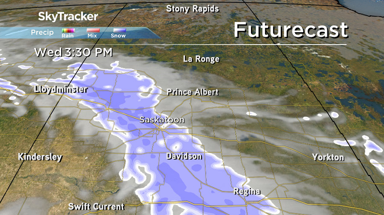
Clouds will build back in early on with light snow moving in midday and sticking around through the afternoon and evening as a low pressure system slides through.
- Storm to bring up to 60 millimetres of rain to parts of Ontario, Quebec
- A ferocious Hurricane Simon nears Mexico with 155 mph winds and flooding fears
- Simon strengthens into a Category 4 hurricane as it approaches Mexico’s coast
- Isaias weakens but flash flooding threat persist as hundred of thousands grapple with power outages


Temperatures should climb back up into minus single digits by noon with an afternoon high around -7 once again with wind chills in the minus teens during the day.
Thursday-Friday
High pressure will pass by north of our area on Thursday, clearing skies out by morning and bringing us back into some sunshine after a cool start with an afternoon high in mid-minus single digits.
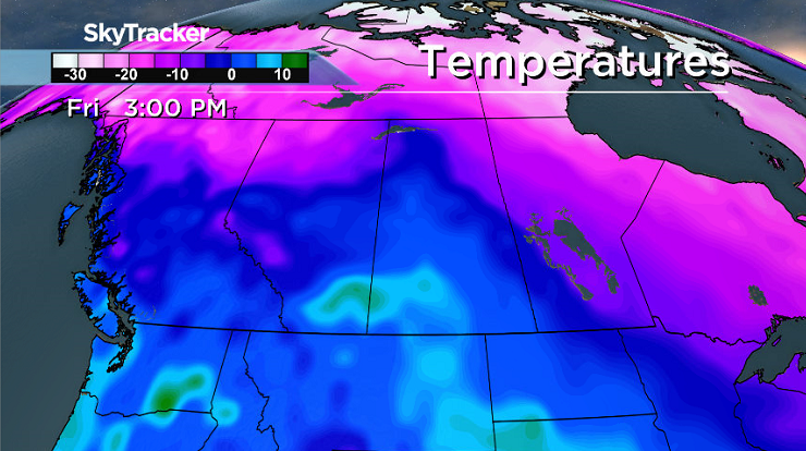
A big warm up is in store on Friday as a kick of mild air ahead of a low pressure system pushing into northern Alberta and Saskatchewan bumps us up above freezing for a high under a mix of sun and cloud.
Weekend Outlook
That low pressure system looks to swing through on Saturday along with a cold front that’ll bring in a good chance of some snow that could accumulate late Saturday into early Sunday before some clearing.
Temperatures should sit around or just below freezing ahead of that front to start the weekend before falling right back into the minus teens early Sunday and only warming into minus single digits later on.
Diane Kacher took this Your Saskatchewan photo near Aberdeen:

Saskatoon weather outlook is your source for Saskatoon’s most accurate forecast and is your one stop shop for all things weather for central and northern Saskatchewan with comprehensive, in depth analysis that you can only find here.


Comments
Want to discuss? Please read our Commenting Policy first.