


UPDATE: All advisories mentioned in this story have ended

Just when you thought it was getting warm, we dive back into the deep freeze … and this time it’ll last a little longer!
Extreme Cold Warning
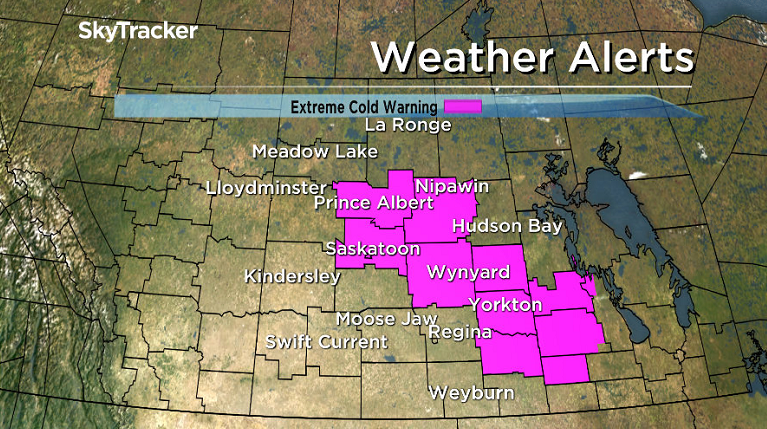
An extreme cold warning has been issued for the Saskatoon, surrounding area, Prince Albert, Yorkton, Humboldt, Melfort and Moosomin areas.
Clearing skies associated with an arctic ridge of high pressure will allow temperatures to plummet to near or below -30 by mid-morning on Friday.
These very cold temperatures combined with winds up to 20 km/h will generate extreme wind chill values of -40 or colder.
Conditions are expected to improve late in the morning as temperatures moderate.
For the latest weather alerts download the Global News Skytracker weather app for iPhone, iPad or Android.
December 2016
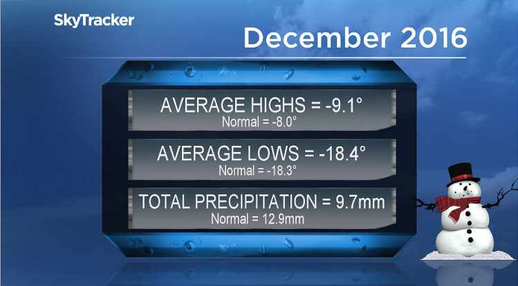
December 2016 was slightly cooler and drier than normal in Saskatoon.
Temperatures trended an average of half a degree below normal, with most of that coming from daytime highs being 1.1 degrees chillier than average.
READ MORE: Saskatoon 1.8 degrees warmer than normal in 2016
In terms of precipitation, the city saw 75 per cent of our average with 9.7 millimetres of melted snow reported when normally we receive 12.9 millimetres throughout the period.
Saskatoon Forecast
Today

Get breaking National news
Cloudy skies and light snow overnight kept temperatures from falling back too far into the -20s with wind chill values making it feel like -26 to start the day.
We did rebound into the mid-minus teens by midday with ice crystals and some light snow glistening in the air, sparkling in some of the sunshine we saw late morning!
This trend is expected to continue for the rest of the day with the mercury bumping up a degree or so, further into the minus teens.
Tonight
Cloudy skies with a chance of light snow will continue this evening before an arctic high surges and clears skies out overnight, dropping temperatures back to around -26 or so.
Friday
-35 is around what it’ll feel like with wind chill Friday morning after clouds clear out of the area overnight.
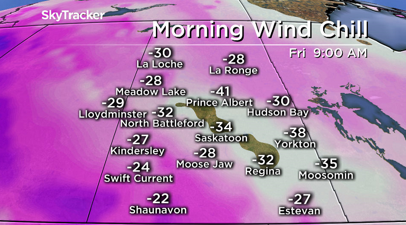


There is a slight chance the clouds might take longer to clear out in the morning, in which case it’ll be a bit milder to start, but I anticipate it to occur overnight.
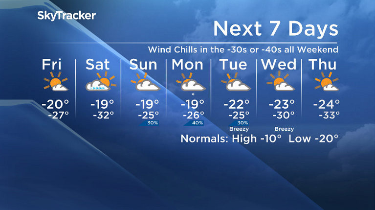
As such, mostly sunny skies will be the dominating feature of the day with temperatures struggling to get up to the -20 degree mark for an afternoon high and wind chills making it feel like the -30s pretty much all day.
Weekend
Extreme cold warnings will likely be warranted on Saturday as temperatures fall into the -30s with wind chills in the -40s to start the day.
Sunny skies will stick around for the morning with some cloud cover building in during the afternoon as the mercury attempts to make it into minus teens for a daytime high.
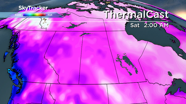
A bit of a disturbance is expected to press in on Sunday, kicking up some more clouds and a slight chance of flurries.
Temperatures should also rebound into the minus teens for an afternoon high that day, but with wind chill should stay in the -30s throughout the day.
Work Week Outlook
Another surge of arctic air moves in next week and as it does so, it’ll sweep through some snow and cloud cover to start the week before sunshine returns later on.
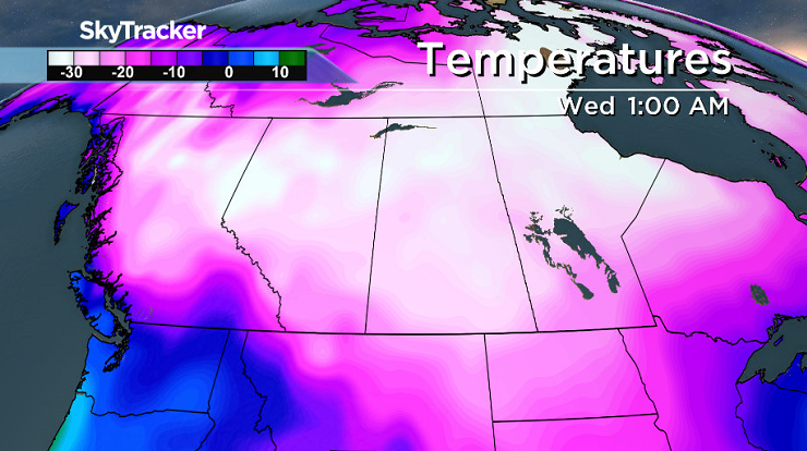
The clouds will help keep us a bit warmer, in the -20s for the most part to start the week before morning lows drop right back into the -30s with afternoon highs in the mid -20s from the middle to end of the week.
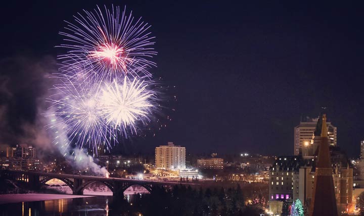
This Your Saskatchewan photo was taken by Taya Grueter of the New Year’s Eve fireworks in Saskatoon:
READ MORE: Get a 2017 Your Saskatchewan calendar today
Saskatoon weather outlook is your one stop shop for all things weather for Saskatoon, central and northern Saskatchewan with a comprehensive look at your local forecast that you can only find here.


Comments
Want to discuss? Please read our Commenting Policy first.