WINNIPEG — It was a dreary weekend throughout most of the province.

Areas in central and northern Manitoba were especially hit the hardest with more rain falling here than in the south.
Winnipeg came out of the weekend with less than 20 mm. of precipitation.
It probably seemed like more rain to many after the grey skies hung around for the bulk of Saturday and Sunday.
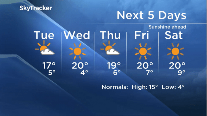
The good news is the weather will begin to take a turn for the better, and by mid-week we’ll be back to sunshine and above normal temperatures.

Get breaking National news
We will however be stuck with the winds for the rest of Monday as the system continues to head east and the winds gust out of the northwest.
As we get into Tuesday, temperatures begin to climb.
The best news is that there’s no rain in our near future (for now).
Here’s how much fell over this past weekend in parts of the province (courtesy Environment Canada):
- Berens River: 65 mm.
- Norway House: 56 mm.
- Thompson: 51 mm.
- Brandon: 51 mm.
- Grand Rapids: 48 mm.
- McCreary: 43 mm.
- Gillam: 39 mm.
- Dauphin: 35 mm.
- Churchill: 31 mm.
- The Pas: 31 mm.
- Winnipeg: 16 mm.


Comments
Want to discuss? Please read our Commenting Policy first.