


Spring came early in Alberta, and so too did tornado season. Environment Canada confirmed Thursday morning that the first tornado of the season in Alberta and the prairies touched down on the east side of Calgary Wednesday afternoon. Two dust devils were also confirmed.

The tiny, EF0 twister — short for “enhanced Fujita scale zero tornado” — happened near Highway 1 and Stoney Trail at around 3:50 p.m. MDT.
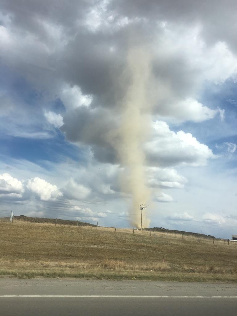
In fact, it was so small, many assumed it was a dust devil. Alex Bull was driving home when he witnessed the startling, but not totally uncommon sight.

“I was turning into the trailer park and then I looked up and there it was,” Bull said.
Bull pulled his vehicle to the side of the road near 17 Avenue and 68 Street S.E. and starting taking a video with his cellphone. He watched what he thought was a tornado rising up before his eyes.
“My thoughts throughout the whole thing were – what if this turns into a real tornado?”
Another Calgarian, Jen Nolin, sent Global News photos from the same area, around the same time.


When Bull got out of his vehicle he figured the weather just wasn’t adding up.
“There was no wind whatsoever, it was sunny, blue skies and just happened to have dark clouds towards the north end of Calgary,” Bull said.

Get daily National news
However, Global Edmonton meteorologist Jesse Beyer said the system, albeit small, was technically a real twister.
“Surface rotation caused by a surface boundary — which is basically two air masses coming together — which got sucked up by an updraft in a convective cloud. The stretching of the vortex increases its speed. This is not the same as a traditional tornado stemming from a super cell,” Beyer explained.
“These are not as strong as traditional super cell tornadoes, but may still cause damage.”
Environment Canada hasn’t determined the length and width of the tornado track, but said no damage was reported, thus the EF0 rating.
“To be rated on the EF scale it has to have a damage assessment, whereas the old F (Fujita) scale was more based on wind speed,” Beyer said. For example, he said with the EF scale, a tornado with winds of 150 km/h that hits an open field would have a lower rating than if it hit a town — even though it would have the same intensity.
The enhanced Fujita scale is used to rate the intensity of tornadoes and damaging wind events. The scale goes from zero being the weakest, to five being the strongest.
Alberta normally has 15 tornadoes each year, in a season that runs from April until September.
Tornado or dust devil? Why there’s an increasingly common ‘twist’ in Alberta’s weather
Two dust devils were also reported in southern Alberta on Wednesday: one near Balzac at approximately 1:45 p.m., and another near Arrowwood at around 5:50 p.m.
According to Global Calgary weather specialist Jodi Hughes, dry, unstable weather across Alberta are causing many dust devils to develop.
On Monday night, Jennifer Beaton took a video of another dust devil whipping across the ground in the Calgary community of Windsong.

WATCH ABOVE: Jennifer Beaton sent Global News this footage of a massive dust devil in Airdrie Monday evening.
This particular one lasted about a minute, according to Bull, “and then just disappeared out of nowhere.”
It was a relief for Bull.
“Living in a mobile home, there’s really no safe zone for it.”
The good news: dust devils never reach the same intensity, and don’t have the ability to become tornadoes.
“Dust devils aren’t attached to the clouds or an active weather systems. A dust devil will form from the ground up, versus a tornado which forms from the cloud and then touches down. They’re also much weaker than a tornado which is why you wouldn’t see the same wind speeds and the same damage left in their wake,” Hughes said.


Comments
Want to discuss? Please read our Commenting Policy first.