
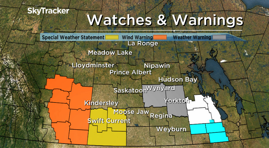
Environment Canada has issued a weather warning for the Yorkton, Melville, Kamsack, Canora, Humboldt areas for freezing rain overnight changing to snow Tuesday. A spring storm system developing over southern Saskatchewan Monday night is forecast to spread a messy mix of wintry precipitation across much of the region by Tuesday.

Precipitation will start off as rain Monday night over southwest Saskatchewan spreading east overnight and as it does so it will encounter colder air over Manitoba causing rain to change to freezing rain from the Quill Lakes area to Yorkton.
Freezing rain will then change to snow Tuesday morning as colder air is drawn into this system.

Get daily National news
Five to 10 centimetres is possible by Tuesday evening over east-central portions of the province.
READ MORE: High temperature records broken in southern Saskatchewan
Elsewhere across southern Saskatchewan, rain is expected to change to snow, albiet a lesser amount closer to two to five centimetres Tuesday along with strong northerly winds.
In addition to the weather warning,a special weather statement has been issued for the southwest corner of the province including Leader, Swift Current and the Cypress Hills for storng north winds with rain changing to snow Tuesday.
As the system tracks east Tuesday, winds will shift to the north with strong gusts to 80 km/h over southwest Saskatchewan and possibly as high as 90 km/h over the Cypress Hills.
The winds will draw in colder air causing rain to change to snow Tuesday morning with poor visibilities at times.
Snowfall amounts of five centimetres are possible for most areas with 10 centimetres or more possible over the Cypress Hills.
Conditions are expected to improve by late Tuesday afternoon as the storm system moves into North Dakota.
For weather on the go download the Global News Skytracker weather app for iPhone, iPad or Android.
Comments